
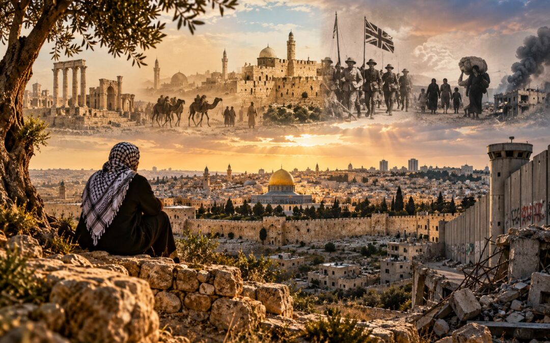
Look at a map of Palestine from 1917, another from 1947, and a third from 1949. The territory appears to change with every image. Add the borders drawn after the 1967 war, the administrative divisions created by the Oslo peace process, and the arrangements governing Gaza and the West Bank today, and the picture becomes even more complicated. Some lines mark territories proposed for independent states. Others show where armies stopped fighting, where military occupation began, or where different authorities exercise control.
These maps are not simply different representations of the same place. Each reflects a political decision, a military outcome, or an attempted settlement that changed who governed the land and what rights its inhabitants could exercise. A family could remain in the same village while the government above it changed, the legal status of its property became contested, or a new boundary separated it from relatives, farmland, or places of worship.
The Israeli–Palestinian conflict is frequently described as an ancient religious struggle, but that explanation obscures the modern political history that produced these competing maps. Jewish and Palestinian connections to the land have deep historical roots. The conflict over modern sovereignty developed through nationalism, immigration, imperial policy, war, displacement, occupation, and unsuccessful negotiations.
The central question is not simply why Palestine’s borders have changed so often. It is why successive attempts to organise the territory have repeatedly established new forms of control without producing an agreed settlement that guarantees Palestinian political rights and sovereignty alongside lasting Israeli security.
Before Palestine Had Modern National Borders
Palestine occupies a narrow but strategically important part of the eastern Mediterranean. The territory connects the Mediterranean coast with the Jordan Valley and lies near the routes linking Egypt, Syria, Arabia, and the wider Middle East. For centuries, armies, traders, pilgrims, and migrating communities passed through it, making the region politically and culturally significant far beyond its geographical size.
Yet Palestine was not historically a single sovereign state with permanent boundaries corresponding to those disputed today. The name has been used for different geographical and administrative territories, while empires governed the region through arrangements that changed over time. Modern maps often impose contemporary political expectations on a past in which borders, identities, and institutions operated differently.
Ancient Israel and Judah emerged in parts of this territory, establishing political and religious traditions central to Jewish history. Conquest, migration, and displacement contributed to the development of a Jewish diaspora over many centuries, although Jewish communities continued living in the land. Jerusalem retained extraordinary religious significance, even as Jewish populations became dispersed across different regions.
Christianity also originated here, and Christian communities developed around sites associated with the life and teachings of Jesus. From the seventh century onward, Muslim conquests brought the region under successive Islamic governments. Arabic gradually became the dominant language of much of the population, and Islam became the majority religion, while Jewish and Christian communities remained important parts of local society.
These histories explain why the same places carry different meanings for different communities. Jerusalem, for example, contains sacred sites of enormous significance to Jews, Christians, and Muslims. Religious attachment, however, does not by itself explain the borders proposed by the United Nations in 1947 or the administrative divisions established in the 1990s. Those emerged from much later political movements and international decisions.
For approximately four centuries before the First World War, Palestine formed part of the Ottoman Empire. Its territory was governed through different provincial and district arrangements rather than as a continuously separate Ottoman province with fixed modern boundaries. Jerusalem, Nablus, Acre, and surrounding districts were connected to wider imperial administrative structures.
Most inhabitants lived in villages and towns, pursuing agriculture, commerce, crafts, and religious or professional occupations. Local communities maintained relationships through families, markets, religious institutions, and regional networks. A person might identify with a village, a faith, an Arabic-speaking cultural world, and the Ottoman Empire without viewing those attachments as contradictory.
This does not mean nationalism or political conflict was absent. It means the modern question of whether a Jewish or Palestinian Arab nation-state should govern the territory had not yet become the dominant framework for political life.
During the nineteenth century, Ottoman reforms, new land-registration systems, expanding commerce, improved transportation, newspapers, and European political influence began changing that environment. Land could increasingly be recorded, bought, and sold within modernising legal arrangements, while new forms of political identity circulated through schools, organisations, and the press.
The decisive break came with the Ottoman Empire’s defeat in World War I. The collapse of imperial government created an opportunity for new states and political movements, but it also allowed European powers to determine the immediate future of territories whose inhabitants had not agreed on a replacement political order.
Palestine entered the twentieth century as an inhabited historical region within an empire. It emerged from the First World War as a territory whose political future would be contested by two developing national movements under British rule.
Two National Movements and Britain’s Contradictory Mandate
Modern political Zionism emerged in nineteenth-century Europe amid profound changes in nationalism, citizenship, and Jewish political life. Although some European Jews gained new civil rights, antisemitic discrimination remained widespread. Violent attacks, exclusion, and increasingly racial forms of antisemitism convinced many Jews that integration into European societies could not guarantee their security.
Zionists argued that Jews were not merely a religious community but also a people entitled to national self-determination. For many supporters, the land historically associated with the ancient Jewish kingdoms offered the most meaningful location for a national home. Theodor Herzl became an influential advocate of organised political Zionism in the 1890s, although Zionist thought included movements with different religious, cultural, socialist, and political objectives.
Not all Jews supported Zionism. Some preferred integration into the countries where they lived, while others opposed the movement for religious or political reasons. Nevertheless, growing persecution strengthened the appeal of creating institutions capable of protecting Jewish collective life.
Jewish immigration to Ottoman Palestine increased during the late nineteenth and early twentieth centuries. Immigrants established agricultural communities, urban neighbourhoods, schools, political organisations, and economic institutions. Some purchased land through recognised legal transactions, while others participated in efforts to create a largely self-sustaining Jewish economy.
These developments took place in a territory already inhabited by a predominantly Arab population. Palestinian Arabs had longstanding connections to their towns, villages, agricultural lands, commercial centres, and religious institutions. Their emerging national identity was influenced by broader Arab political movements, Ottoman reforms, local attachments, and growing concern about the consequences of Zionist settlement.
Land transactions provide a useful example of how these two political projects could collide even without an immediate dispute over international borders.
An estate might be purchased from a legal owner who lived elsewhere, while tenant farmers continued cultivating land on which their families had depended for generations. A transaction could transfer recognised ownership without giving those farmers equivalent protection over their livelihoods. In some cases, tenants were displaced or lost access to fields following purchases and changes in land use.
Not every sale produced displacement, and the scale and circumstances varied. But the underlying problem was larger than individual transactions. Zionist institutions were building the foundations of a future Jewish national society, while many Palestinian Arabs increasingly feared becoming politically subordinate within their own homeland.
The Arabic-language newspaper Filastin, founded in Jaffa in 1911, became one of the forums through which these concerns were expressed. Palestinian journalists and political figures debated immigration, landownership, representation, and the future of the territory. Their arguments reflected a developing political consciousness rather than the sudden appearance of Palestinian identity after 1948.
The First World War transformed these local and regional disputes into an international political problem.
Britain had strategic interests in the eastern Mediterranean, particularly because Palestine lay near Egypt and the Suez Canal. Control of routes connecting Britain to its wider empire was a central consideration in Britain’s imperial strategy. As Ottoman rule weakened, British policymakers considered how the region might be organised after the war.
Their diplomatic commitments created competing expectations.
During the Hussein–McMahon correspondence of 1915–16, British officials encouraged Arab hopes for independence in return for support against the Ottoman Empire. The territorial scope of those commitments subsequently became disputed, particularly whether Palestine was included.
In 1916, Britain and France negotiated the secret Sykes–Picot Agreement, outlining proposed spheres of influence and control across parts of the Ottoman Arab territories. It was not implemented exactly as written, but it demonstrated that European powers were planning political arrangements for the region while Arab leaders were pursuing independence.
Then, in November 1917, Britain issued the Balfour Declaration.
The declaration expressed British support for the establishment of a national home for the Jewish people in Palestine. It also stated that the civil and religious rights of existing non-Jewish communities should not be prejudiced.
That wording carried enormous political consequences.
The declaration did not explicitly promise an immediately sovereign Jewish state. Nevertheless, it provided the Zionist movement with formal support from a major imperial power. At the same time, it described Palestine’s Arab majority as non-Jewish communities whose civil and religious rights deserved protection, without expressly recognising an equivalent Palestinian Arab right to national self-determination.
The distinction was fundamental. Britain endorsed one national aspiration while leaving the political future of the majority population unresolved.
After the war, Britain took control of Palestine under a League of Nations Mandate that incorporated the Balfour Declaration’s commitments. British officials governed the territory, maintained security, administered institutions, and regulated immigration, while the two national movements increasingly developed competing expectations about the eventual transfer of power.
Jewish political and social institutions became progressively stronger. Organisations associated with the Zionist movement developed representative structures, financial networks, educational systems, agricultural settlements, and armed groups. These institutions later provided important organisational foundations for the Israeli state.
Palestinian Arabs continued developing political organisations and mobilising against British policy, increasing Jewish immigration, and the prospect of losing national control. They objected not simply to the arrival of individual immigrants but to the political project of creating a Jewish national home in a country where Arabs constituted the majority.
Violence intensified during the 1920s and 1930s. Disputes over immigration, land, religious sites, political authority, and British administration produced clashes in which both Jewish and Arab civilians were attacked.
The crisis escalated in 1936, when a Palestinian general strike developed into a wider revolt against British rule and Zionist immigration. The uprising lasted until 1939 and involved strikes, boycotts, armed resistance, and attacks on British and Jewish targets.
Britain suppressed the revolt through extensive military operations, emergency regulations, arrests, and other coercive measures. Many Palestinian political leaders were killed, imprisoned, exiled, or otherwise weakened. The suppression reduced the organisational capacity of Palestinian Arab society at a particularly consequential moment.
British policy also changed under pressure. The 1939 White Paper proposed restrictions on Jewish immigration and a future independent Palestine. These restrictions alienated Zionist leaders and became particularly devastating to Jewish hopes of refuge as persecution in Europe intensified.
The Holocaust transformed the political circumstances. Nazi Germany and its collaborators murdered approximately six million European Jews, destroying communities and leaving survivors displaced across Europe. For many survivors, returning to their former homes was dangerous, impossible, or deeply undesirable. The demand for secure refuge and Jewish statehood acquired extraordinary urgency.
Palestinian Arabs did not deny that European Jews had suffered catastrophic persecution. Their central political objection was that the consequences of crimes committed primarily in Europe should not require them to surrender their own national aspirations or accept political subordination.
By the end of the Second World War, Britain had established an administration but failed to create an accepted constitutional future. Both movements sought national self-determination in the same territory, and neither was prepared to accept an arrangement that appeared to deny its essential claims.
Britain eventually turned the problem over to the newly established United Nations. The next proposal would draw a partition map, but its political authority would be decided through war rather than peaceful implementation.
The 1947 Partition Plan, Israel’s Creation, and the Nakba
In November 1947, the United Nations General Assembly adopted Resolution 181, recommending the partition of British Mandatory Palestine into separate Jewish and Arab states. Jerusalem and its surrounding area were to receive a special international regime because of their religious significance and the conflicting national claims surrounding the city.
The UN’s 1947 partition recommendation proposed a territorial settlement, but it was not a functioning political settlement. Drawing boundaries on a map did not automatically establish two independent governments, determine the practical division of institutions and infrastructure, or secure the consent of those expected to live under the arrangement.
The proposed Jewish state received a larger share of the territory than its proportion of the overall population. The allocation reflected several geographical and political considerations, including the Negev desert and areas containing substantial Jewish communities. Nevertheless, the imbalance became one of the principal objections raised by Palestinian Arab leaders and neighbouring Arab governments.
Mainstream Zionist leaders accepted partition in principle, although they disputed some proposed boundaries and continued debating the future of Jerusalem. Acceptance reflected the opportunity to establish an internationally supported Jewish state after decades of political organisation and the catastrophe of the Holocaust.
Palestinian Arab leaders and Arab states rejected the proposal. They argued that the country’s Arab majority should not be deprived of political authority over substantial territory and that the plan violated the principle of majority self-determination.
Both positions were shaped by existential concerns. Many Jews saw statehood as a necessary guarantee against persecution and political vulnerability. Palestinians feared that partition would legitimise the loss of territory, political authority, and security in a country where their communities had longstanding roots.
The United Nations had proposed a division of sovereignty, but it had not produced a practical means of implementing it with the agreement of both sides.
Violence escalated almost immediately after the November 1947 vote. Jewish and Palestinian Arab armed groups fought over roads, towns, neighbourhoods, and strategic positions as British withdrawal approached. The fighting was initially a civil war within the territory still nominally governed by Britain.
Jewish forces possessed increasingly effective military and political organisation, including networks developed during the Mandate. Palestinian Arab forces were less unified, and the weakening of Palestinian leadership after the 1936–39 revolt compounded their difficulties.
As fighting intensified, control of individual towns and transport routes became increasingly important. Military operations also produced widespread civilian fear and displacement.
On 14 May 1948, David Ben-Gurion declared the establishment of the State of Israel as British rule ended. Armies from neighbouring Arab countries entered the war shortly afterward, expanding the conflict beyond the fighting between Jewish and Palestinian Arab forces.
The war became a defining event for both peoples, but its consequences were profoundly different.
For Israelis, 1948 marked the establishment of sovereign statehood after decades of Zionist organisation and the destruction of European Jewry. Israel survived military confrontation, established governing institutions, and consolidated territory beyond that allocated to the proposed Jewish state under the UN plan.
For Palestinians, the war became the Nakba, meaning catastrophe. Approximately 700,000 Palestinians fled or were expelled from their homes during the fighting and its aftermath. Hundreds of communities were depopulated, and many villages were subsequently destroyed or transformed.
The circumstances of displacement differed significantly.
Some families escaped active combat or approaching military operations. Others fled because of fear, news of atrocities, or the collapse of local institutions. Some received evacuation instructions from local authorities. In documented cases, Israeli forces directly expelled Palestinian communities.
It would be historically misleading to describe every Palestinian departure as a voluntary evacuation. It would also obscure the evidence to assume that every displaced family experienced an identical military process. The history includes different local circumstances, military decisions, and contested questions about overall policy and responsibility.
The events at Lydda, known in Arabic as al-Lydd and today as Lod, illustrate the scale of the tragedy.
Israeli forces captured Lydda and neighbouring Ramle in July 1948 during Operation Dani. Most of Lydda’s Palestinian inhabitants were forced to leave, while many residents of Ramle were also expelled or displaced. Families travelled eastward toward territory held by Arab forces, some enduring a difficult journey through intense summer heat with few possessions.
The significance of Lydda extends beyond the suffering of one community. It demonstrates how military control could transform a town’s population and political status in a matter of days. The boundary between areas controlled by different armies became a question of whether displaced residents could return to their homes.
After the war, Israel generally prevented the mass return of Palestinian refugees. Much abandoned and confiscated property came under new legal and administrative arrangements, including transfers of land and buildings into Israeli control. Questions of ownership, compensation, restitution, and return became permanent features of the dispute.
Refugees settled in the West Bank, Gaza, Jordan, Lebanon, Syria, and elsewhere. Camps established to provide temporary shelter developed into enduring communities as generations grew up without a comprehensive resolution of their displacement.
The refugee question therefore concerns more than humanitarian assistance. It involves property claims, national identity, family histories, legal rights, and competing interpretations of responsibility. Palestinian demands for return and compensation remain central to the conflict, while Israel has raised concerns about the consequences of large-scale return for its demographic and political character.
The war also produced territorial arrangements very different from those envisaged by the United Nations.
Israel controlled approximately 77 percent of the territory of British Mandatory Palestine, excluding Transjordan. Jordanian forces held the West Bank, including East Jerusalem, while Egypt administered the Gaza Strip. Jerusalem itself was divided, with Israel controlling the western part of the city and Jordan controlling the eastern part, including the Old City.
The Palestinian Arab state proposed in 1947 did not emerge.
This outcome illustrates the first major distinction necessary for understanding Palestine’s modern maps. The UN partition map represented a political recommendation for two states. The map produced by the 1948 war represented actual military control and the territorial distribution that followed the fighting.
Those were not the same map, and they did not possess the same legal meaning.
The subsequent armistice agreements established lines separating the military forces, but they did not resolve competing claims to sovereignty. For Israel, independence had become a political reality. For Palestinians, statehood remained unrealised, while much of their society had been displaced and their territory divided among different governments.
The next generation inherited neither the original Mandate territory nor the two-state arrangement proposed by the United Nations. It inherited a new political geography created through war.
The Green Line, the 1967 War, and Military Occupation
The fighting of 1948 ended through a series of armistice agreements negotiated in 1949 between Israel and neighbouring Arab states. These arrangements established military demarcation lines intended to separate forces and reduce the possibility of renewed hostilities.
The most important of these boundaries became known as the Green Line, a name associated with the colour used to mark it on maps.
The distinction between an armistice line and an international border is essential.
A border ordinarily separates territories under different sovereign jurisdictions and may be established through treaties or other recognised legal arrangements. An armistice line records where forces agreed to stop fighting or withdraw, without necessarily resolving which state has legal sovereignty over the land concerned.
The 1949 Egyptian–Israeli Armistice Agreement expressly distinguished its military demarcation arrangements from a final territorial settlement. The broader series of armistice agreements likewise left political boundaries unresolved.
Over time, however, the Green Line acquired enormous diplomatic importance. It became the principal reference point for distinguishing Israel’s pre-1967 territory from the territories captured during the Six-Day War. International proposals for a two-state settlement frequently use the 1967 lines, often with the possibility of mutually agreed territorial exchanges, as their starting point.
Between 1949 and 1967, the West Bank and Gaza followed different political paths.
Jordan controlled the West Bank and East Jerusalem and formally annexed the West Bank in 1950, although that annexation received only limited international recognition. Egypt administered Gaza without incorporating it as ordinary Egyptian sovereign territory.
Neither arrangement created an independent Palestinian state. Palestinians living in these territories experienced different political and legal circumstances, while those who had become refugees elsewhere remained separated from their former homes.
Palestinian citizens within Israel also occupied a different position. They became part of the new Israeli state, although many lived under military administration during its early decades and faced significant restrictions. Their experiences differed from those of refugees and Palestinians living under Jordanian or Egyptian administration.
The result was a divided Palestinian population governed through multiple political systems, even before Israel occupied the West Bank and Gaza.
In June 1967, another war fundamentally changed the map.
Amid escalating regional tensions, military mobilisation, and confrontation with neighbouring states, Israel launched attacks against Egyptian forces and subsequently fought Egypt, Jordan, and Syria. Within six days, Israel captured the Sinai Peninsula and Gaza from Egypt, the West Bank and East Jerusalem from Jordan, and the Golan Heights from Syria.
This victory placed the West Bank, East Jerusalem, and Gaza under Israeli military control. The territorial situation created by the 1949 armistice agreements had been transformed.
Yet occupying territory does not automatically make it part of the occupying state’s sovereign territory under international law.
Israel extended its law and administration to East Jerusalem and later declared the city its unified capital. Most of the international community has not recognised its annexation of East Jerusalem. The West Bank remained under military occupation, with different arrangements governing Israeli settlers and Palestinian residents.
Israel also began establishing settlements in territories captured in 1967. Some were connected to religious or historical claims, while others reflected strategic, political, economic, or ideological objectives. Settlement construction and expansion became among the most consequential developments affecting the possibility of a territorially viable Palestinian state.
Consider the practical implications for people living in the same geographical area.
A Palestinian farmer might cultivate land close to an Israeli settlement while being subject to military regulations and restrictions on movement. Access to fields could depend on permits, checkpoints, military orders, or the position of security infrastructure.
Israeli settlers, meanwhile, generally lived under a system in which Israeli civilian law and institutions applied to them through various legal mechanisms, even though their settlements were situated in occupied territory. Palestinians in nearby communities were subject to a different legal and administrative framework.
The territory could appear geographically continuous on a map while operating through separate systems of authority.
Israel has defended settlement activity and its security policies through arguments involving historical connections, disputed territorial status, strategic necessity, and the protection of Israeli citizens. Palestinian leaders have regarded settlement expansion as the appropriation of land intended for their future state and a direct obstacle to meaningful sovereignty.
The prevailing international legal position differs from Israel’s interpretation. The United Nations Security Council, including through Resolution 2334 in 2016, has maintained that Israeli settlements in territory occupied since 1967 lack legal validity and violate international law. Israel disputes significant aspects of that assessment.
Occupation also raised questions about the rights of the civilian population, military necessity, property protection, and whether restrictions initially described as temporary had developed into enduring political arrangements.
Diplomacy altered some consequences of the 1967 war without resolving the Palestinian question.
Egypt and Israel signed a peace treaty in 1979 following the Camp David negotiations. Israel subsequently withdrew from Sinai, allowing Egypt to recover the territory through a negotiated process. Israel and Jordan signed a peace treaty in 1994, establishing their internationally agreed boundary while leaving questions relating to the occupied Palestinian territories unresolved.
These agreements show that conflict-related borders can become settled through diplomacy. Israel does have internationally agreed boundaries with neighbouring states, and it would be inaccurate to suggest that every border involving Israel remains undetermined.
The central unresolved territorial question concerns Palestinian sovereignty and the final status of the West Bank, East Jerusalem, and Gaza.
By the late 1980s, Palestinian frustration with prolonged occupation, settlement expansion, military restrictions, and the absence of statehood had intensified. A generation had grown up under arrangements originally described in the language of military occupation but with no agreed end in sight.
In 1987, an uprising began that fundamentally changed the politics of the conflict and eventually opened the way to a new diplomatic experiment.
How Oslo Turned a Temporary Arrangement Into Fragmented Rule
The First Intifada began in December 1987 and spread across the West Bank and Gaza. Palestinians organised demonstrations, strikes, boycotts, and other forms of resistance against Israeli occupation. The uprising also involved attacks and other violence, while Israeli authorities responded with arrests, military operations, and force.
The uprising demonstrated that Palestinian opposition to the existing arrangements could not be understood solely through the activities of neighbouring Arab governments or the Palestine Liberation Organization operating abroad. Political mobilisation had developed within the occupied territories themselves.
During this period, Hamas emerged as an Islamist Palestinian movement combining social, political, and armed activities. It opposed Israel and challenged the secular nationalist leadership associated with the Palestine Liberation Organization, or PLO.
The PLO had become the internationally recognised representative of the Palestinian national movement and gradually moved toward a negotiated two-state approach. Diplomatic developments after the Intifada eventually produced a major breakthrough.
In September 1993, Israeli Prime Minister Yitzhak Rabin and PLO Chairman Yasser Arafat participated in the signing of the first Oslo agreement. Israel and the PLO had exchanged letters of mutual recognition, and the agreement established a framework for limited Palestinian self-government and further negotiations.
For many observers, Oslo appeared to offer a practical route toward resolving the conflict.
Palestinians would establish governing institutions in designated areas as Israel transferred specified administrative responsibilities and withdrew or redeployed forces from certain locations. A transitional period would provide time for negotiations over the hardest questions.
The Palestinian Authority was created to exercise these limited governing responsibilities. It was not an independent sovereign state, and its powers depended on the terms of the agreements and subsequent implementation.
The arrangement’s central limitation was that the most difficult questions were postponed rather than settled.
Jerusalem, permanent borders, settlements, refugees, security arrangements, and full sovereignty remained matters for later negotiations. The success of the entire process therefore depended on temporary institutions leading toward a political settlement that both sides would eventually accept.
The 1995 Israeli–Palestinian Interim Agreement, commonly called Oslo II, established one of the most important administrative divisions of the modern West Bank.
The agreement distinguished between Areas A, B, and C, each involving different distributions of civil and security responsibilities.
In Area A, the Palestinian Authority was assigned responsibility for civilian affairs and internal security in designated Palestinian population centres. This did not amount to complete sovereignty or eliminate Israel’s capacity to conduct military operations.
In Area B, the Palestinian Authority exercised civil responsibilities, while Israel retained overriding security responsibilities under the interim arrangements. The resulting system divided administrative functions that would ordinarily be associated with one unified government.
In Area C, Israel retained extensive civil and security authority, including powers affecting planning, construction, land use, and other aspects of territorial administration. This area encompassed most of the West Bank’s land area and included Israeli settlements and substantial areas of open land.
East Jerusalem occupied a different legal and administrative position, reflecting Israel’s extension of its laws there and the unresolved international dispute over the city’s status.
These divisions were designed as interim arrangements. Their intended purpose was not to establish three permanent kinds of Palestinian territory.
Yet their effects became increasingly entrenched.
A resident might leave a Palestinian town under Palestinian Authority administration, travel along roads where Israeli checkpoints controlled passage, and pass through territory in which Israeli authorities regulated planning or security. The journey could involve several changes in practical jurisdiction without crossing a recognised international boundary.
The difference mattered for ordinary activities.
A person travelling to work might face restrictions that affected access to employment. A farmer might need permission to reach agricultural land. A business could encounter difficulties transporting goods between communities. Planning a home or building infrastructure could depend on which authority controlled the relevant land.
The physical geography of the West Bank became inseparable from its administrative divisions.
Israeli settlements, connecting roads, security installations, military areas, and the separation barrier further influenced movement and patterns of development. The precise effect varied by location, and not every road or checkpoint operated in the same way. Nevertheless, the cumulative result was a fragmented landscape in which Palestinian communities often lacked continuous authority over the surrounding territory.
The settlement issue became particularly important because the land assigned to Area C included areas central to the geographical continuity of a future Palestinian state. Even where Palestinian institutions administered densely populated towns, they did not necessarily control the roads, resources, or surrounding land required for a unified territorial system.
Israel maintained that security arrangements were necessary to protect its population from attacks and preserve the conditions under which negotiations could proceed. Palestinian critics argued that continued settlement expansion and Israeli territorial control were undermining the very sovereignty that the peace process was supposed to deliver.
Political violence intensified the crisis.
In November 1995, an Israeli extremist assassinated Prime Minister Yitzhak Rabin, who had become closely associated with the peace process. The assassination deepened an already difficult political transition.
Israeli–Palestinian negotiations continued, but trust deteriorated amid settlement expansion, Palestinian militant attacks, disputes over implementation, and political disagreements within both societies.
The Second Intifada began in 2000 and developed into a much deadlier confrontation. Palestinian armed groups carried out attacks, including suicide bombings that killed Israeli civilians. Israeli forces conducted extensive military operations, including incursions into Palestinian cities, arrests, and the reoccupation of areas from which they had previously withdrawn.
Israel subsequently constructed a separation barrier, describing it as a necessary measure to prevent attacks. Attacks against Israelis declined, but the barrier’s route became intensely controversial because significant portions extended inside the occupied West Bank rather than following the Green Line.
For affected Palestinians, the barrier could separate communities from agricultural land, workplaces, schools, medical facilities, or neighbouring towns. Israel emphasised the security need to protect its population, while Palestinian organisations and international legal bodies challenged the barrier’s location and its effects on people living under occupation.
The International Court of Justice issued a 2004 advisory opinion addressing the legal consequences of constructing the barrier within occupied Palestinian territory. Israel disputed the Court’s approach and maintained that the barrier served legitimate security purposes.
By this point, Oslo’s temporary arrangements had failed to achieve their stated political objective. Negotiations had produced Palestinian institutions and limited self-government, but not an agreed final border or independent state.
That distinction is central to understanding the modern map.
The Palestinian Authority could govern aspects of daily life without exercising full territorial sovereignty. Israel could transfer certain administrative functions while retaining extensive military and geographical control. Meanwhile, settlements and infrastructure continued changing the practical organisation of the territory.
A peace process intended to replace occupation with an agreed political settlement had instead left a durable system of divided responsibilities.
The next major development would deepen the separation between the West Bank and Gaza, producing rival Palestinian governments and a further disagreement over the meaning of territorial control.
Gaza, the West Bank, and the Split in Palestinian Government
In 2005, Israel withdrew its permanent ground forces and removed Israeli settlements from the Gaza Strip. The disengagement marked an important change in the territory’s internal administration, ending the permanent Israeli settlement presence there.
But withdrawal did not create an independent Palestinian state.
Israel retained significant control over Gaza’s airspace, maritime access, and most land crossings, as well as other functions affecting the territory. Egypt controlled its own crossing at Rafah, and the practical operation of border arrangements depended on political and security conditions.
The legal significance of these arrangements became disputed. Israel argued that the withdrawal ended its occupation of Gaza, while the United Nations, the International Court of Justice, and many legal authorities continued to treat Gaza as occupied Palestinian territory, considering the forms of effective control Israel retained and later exercised. Occupation law focuses on effective authority rather than the presence of permanent settlements alone.
Gaza’s government also changed dramatically.
Hamas won the 2006 Palestinian legislative election, challenging the political dominance of Fatah, the movement associated with much of the Palestinian Authority’s leadership. Political rivalry developed into violent confrontation, and in 2007 Hamas established control over Gaza.
The Palestinian Authority, led by Fatah, continued exercising limited authority in parts of the West Bank. Palestinians consequently became divided between rival governing organisations, each claiming political legitimacy under different circumstances.
This division made the territorial problem even more difficult.
The Palestinian national movement had long sought self-determination across the West Bank and Gaza, with East Jerusalem central to its aspirations. Yet its principal territories were now governed through different political institutions, and their rulers disagreed over strategy, representation, relations with Israel, and the legitimacy of armed resistance.
After Hamas took control of Gaza, Israel imposed extensive restrictions and a blockade on the territory, while Egypt also restricted movement through its border crossing. Israel justified major security measures by citing Hamas’s military capabilities, rocket attacks, and threats to Israeli civilians.
Hamas and other Palestinian armed groups launched rockets toward Israel, while Israeli military campaigns caused extensive destruction and civilian casualties in Gaza. Hamas also repressed political opponents and restricted dissent within the territory it governed.
These developments created competing forms of insecurity and sharply unequal capacities to control territory, movement, and resources.
For Israeli communities exposed to attacks, security and the prevention of further violence were immediate concerns. For Palestinians in Gaza, restrictions on movement, commerce, electricity, healthcare, and infrastructure affected nearly every dimension of daily life.
Repeated wars damaged housing, public facilities, and economic activity. The blockade and recurring fighting made it difficult to develop the stable institutions and infrastructure ordinarily associated with meaningful sovereignty.
The West Bank followed a different trajectory.
The Palestinian Authority continued administering designated areas, while Israel retained substantial military and territorial powers. Settlement expansion, military operations, restrictions on movement, and violence involving Israeli settlers and Palestinian armed groups further complicated the situation.
A Palestinian living in Ramallah did not experience the same system of government as someone living in Gaza City. Both belonged to a national movement seeking self-determination, but their territories were separated by geography, political rivalry, and different arrangements of Israeli control.
The resulting fragmentation cannot be explained solely by internal Palestinian divisions. The broader question of occupation, borders, and sovereignty predated the Hamas–Fatah split, and the division did not settle any of those underlying disputes.
By 2007, the map had acquired another political layer: separate Palestinian governments, limited Palestinian Authority administration in the West Bank, Hamas rule within Gaza, and continuing Israeli control exercised in different forms across the two territories.
Neither the withdrawal from Gaza nor the creation of Palestinian institutions had produced an agreed and unified sovereign territory.
October 2023 to October 2026: War, Law, and Territorial Control
On 7 October 2023, Hamas-led Palestinian armed groups attacked southern Israel, targeting civilian communities, a music festival, and military positions. Approximately 1,200 people were killed, and around 250 were taken hostage into Gaza.
The deliberate killing of civilians and hostage-taking constituted grave violations of international humanitarian law. The longer history of occupation, blockade, and Palestinian dispossession provides essential context for understanding the conflict, but it does not justify attacks on civilians or remove the legal responsibility of those who carried them out.
Israel responded with an extensive military campaign in Gaza, stating that its objectives were to defeat Hamas, prevent further attacks, and recover hostages.
The war caused catastrophic Palestinian suffering. Large numbers of civilians were killed or injured, families were repeatedly displaced, and homes, schools, hospitals, roads, and water infrastructure suffered enormous damage. The destruction also made access to healthcare, education, food, shelter, and other essential services increasingly difficult.
The conflict raised urgent questions about the conduct of military operations, humanitarian access, protection of civilians, hostage-taking, forced displacement, and the responsibilities of governments and armed groups under international law.
These questions entered several international legal proceedings, but the proceedings concerned different legal issues and must not be confused.
In July 2024, the International Court of Justice issued an advisory opinion on the legal consequences of Israel’s policies and practices in the occupied Palestinian territory, including East Jerusalem. The ICJ’s 2024 advisory opinion concluded that Israel’s continued presence in the occupied Palestinian territory was unlawful and addressed the consequences for states and international organisations.
The opinion examined the long-term occupation, settlement activity, restrictions affecting Palestinians, and the right of the Palestinian people to self-determination. It was an advisory opinion rather than a criminal conviction of individual officials, but it represented an important authoritative statement of international law.
Israel rejected the Court’s principal conclusions, maintaining that the opinion failed to account adequately for historical claims, security considerations, and the necessity of direct negotiations.
A separate ICJ case was brought by South Africa in December 2023 under the Genocide Convention. South Africa alleged that Israel had violated its obligations under the convention in relation to Palestinians in Gaza. Israel rejected the allegation of genocide and defended its military campaign as directed against Hamas.
The Court ordered provisional measures in 2024 concerning the protection of Palestinians and the obligations of the parties under international law. These were interim judicial measures, not a final finding that genocide had occurred.
As of October 2026, the South Africa v. Israel proceedings were continuing, and the Court had not issued a final judgment on the merits of the genocide allegation. That distinction matters because legal proceedings can impose obligations and address urgent risks without having resolved every underlying accusation.
The International Criminal Court addressed a different question: the potential criminal responsibility of individuals.
In November 2024, the ICC issued arrest warrants for Israeli Prime Minister Benjamin Netanyahu and former Defence Minister Yoav Gallant, alleging responsibility for war crimes and crimes against humanity. The Court’s announcement concerning the warrants and jurisdictional challenges concerned individual criminal proceedings rather than the settlement of borders or sovereignty.
Arrest warrants are not convictions. They indicate that the Court found the applicable legal threshold for issuing warrants satisfied, while the allegations remain subject to criminal proceedings and the rights of the accused.
The distinction between these international courts is important because legal accountability and territorial settlement are different processes. A court may address the lawfulness of occupation, alleged violations of a convention, or individual criminal responsibility without directly establishing the final internationally agreed border between Israel and a Palestinian state.
The political geography of the conflict continued changing as the war developed.
After extensive fighting and repeated displacement, a ceasefire arrangement was announced in October 2025. Yet a ceasefire did not amount to a comprehensive peace settlement, a permanent agreement on Gaza’s government, or an internationally recognised territorial border.
Ceasefire-era arrangements included the so-called Yellow Line inside Gaza, associated with military positions and the distribution of control under the agreement. This line was not equivalent to the Green Line or to the international boundary of an independent Palestinian state. Its function concerned the immediate military arrangement rather than a final political settlement.
The distinction became evident as violence and humanitarian emergencies continued.
In its Humanitarian Situation Report dated 22 October 2026, published on 26 October, the United Nations Office for the Coordination of Humanitarian Affairs documented continuing Israeli airstrikes, shelling, gunfire, and reported incidents near Gaza’s Yellow Line. The report also described severe shortages of medical supplies, widespread dependence on damaged or inadequate shelters, and difficulties maintaining food and water assistance.
UNICEF reported that hundreds of children had been killed in Gaza since the October 2025 ceasefire announcement. Humanitarian agencies warned that funding shortages, restrictions on the entry of supplies, and damaged infrastructure continued undermining the ability to provide essential services.
These conditions demonstrated the difference between a reduction in large-scale hostilities and the establishment of lasting civilian security.
The West Bank presented a related but distinct picture.
OCHA documented continued Israeli military operations, settler violence, demolitions, restrictions on access to land, and difficulties reaching essential services. During the 2026 olive harvest, attacks and movement restrictions affected Palestinian farmers attempting to cultivate or harvest their land.
This example demonstrates why territorial control cannot be understood only through national maps.
A farmer’s access to an olive grove may depend on the placement of checkpoints, restrictions imposed by military authorities, or the presence of settlers and security infrastructure. The land may lie within a territory claimed for a future Palestinian state, but the practical ability to use it can depend on a different authority.
At the same time, Israeli civilians continued facing security threats connected to armed attacks and the unresolved conflict. Sustainable arrangements would therefore have to address both the protection of civilians and the political system governing the territory.
By October 2026, the map of Palestine still reflected overlapping systems of military authority, Palestinian administration, settlement infrastructure, border restrictions, and contested claims of sovereignty.
International court proceedings had clarified significant legal questions, and ceasefire negotiations had produced temporary changes in military arrangements. Neither had created a comprehensive political settlement capable of resolving the territorial questions inherited from the previous century.
What a Final Map Would Still Have to Resolve
The history of Palestine’s borders contains several different kinds of maps, and their meanings cannot be reduced to a single territorial dispute.
Ottoman administrative maps reflected imperial government. The British Mandate established a new administration under international authority. The 1947 UN plan proposed a partition that was never implemented as envisaged. The 1949 armistice agreements recorded the outcome of war without establishing a comprehensive permanent settlement.
The 1967 war brought the West Bank, East Jerusalem, and Gaza under Israeli military control. Oslo introduced limited Palestinian self-government and divided administrative responsibilities without resolving sovereignty. Gaza’s 2005 disengagement and the subsequent Palestinian political split created further distinctions between internal administration and external control.
Every stage changed the political reality on the ground. None produced the mutually accepted final settlement that would resolve the central Palestinian–Israeli territorial dispute.
The unresolved issues are connected, which makes them difficult to settle separately.
Borders remain central because a Palestinian state would require an agreed territory over which it could exercise meaningful sovereignty. Negotiations have repeatedly considered the 1967 lines, including possible mutually agreed land swaps, but the location and status of settlements, security infrastructure, and other territorial arrangements complicate the question.
Jerusalem carries national, historical, and religious significance for both peoples. Israel regards Jerusalem as its capital, while Palestinians seek East Jerusalem as the capital of a future state. Any final agreement would have to address political jurisdiction, access to sacred sites, and the protection of the city’s diverse communities.
Settlements affect both the legal and practical organisation of the West Bank. Their location, growth, transport connections, and security arrangements influence the territorial continuity available for Palestinian self-government. A settlement would have to address the rights, status, and security of people living in or near those communities while complying with applicable international law.
Refugees remain one of the most consequential unresolved questions from 1948. Palestinian claims concerning return, restitution, compensation, and recognition of displacement coexist with Israeli concerns over demographic change, national identity, and security. The question cannot be reduced to a technical decision about where a boundary line should be drawn.
Security is equally essential to any durable settlement. Israel seeks protection against attacks on its civilians and guarantees that neighbouring territory will not be used for military assaults. Palestinians seek freedom from occupation, coercive restrictions, displacement, and the insecurity associated with lacking effective sovereign authority. Those requirements involve political institutions and enforceable arrangements, not simply the placement of borders.
Palestinian political representation adds another dimension. The separation between Hamas’s rule in Gaza and Palestinian Authority administration in parts of the West Bank complicates questions of negotiating authority, democratic legitimacy, governance, and the implementation of any eventual agreement.
These problems are not identical, and their legal and historical foundations differ. But they intersect in ways that explain why apparently straightforward proposals have proved so difficult to implement.
A border agreement that ignores refugees would leave a major historical claim unresolved. A Palestinian administration without control over territory and movement would lack important characteristics of sovereignty. A security arrangement without recognised political rights could reproduce the instability it was intended to prevent.
International recognition adds another layer to this distinction.
In 2012, the United Nations General Assembly granted Palestine non-member observer State status. This strengthened Palestine’s international diplomatic position and reflected widespread recognition of the Palestinian claim to statehood.
During 2025, additional countries, including France, formally recognised the State of Palestine. Such recognition can carry considerable diplomatic and legal significance, supporting the principle of Palestinian self-determination and influencing international negotiations.
Nevertheless, recognition alone does not establish effective control over territory.
A government may be recognised internationally without possessing full authority over its claimed borders, airspace, security arrangements, natural resources, or institutions. Conversely, a military power may exercise extensive control over territory without that control being recognised as lawful sovereignty.
This is one of the central lessons of the conflict.
A map showing where authority is exercised is not necessarily a map of internationally recognised sovereignty.
The same distinction applies to the various territorial lines that have appeared in diplomatic negotiations and military agreements. A proposed partition boundary represents one political vision. A ceasefire line may reflect an immediate military arrangement. An internationally recognised border requires a different legal and political foundation.
The Israeli–Palestinian conflict also exists within the wider history of conflict in the Middle East, involving regional powers, foreign intervention, ideological competition, and changing alliances. These relationships influence negotiations and security calculations, but they do not eliminate the specific questions of Palestinian national rights and Israeli security.
It is also important not to confuse the absence of an agreed Palestinian territorial settlement with the claim that Israel has no recognised borders anywhere. Israel has concluded peace treaties establishing boundaries with Egypt and Jordan. The unresolved questions concern particular territories, claims, and political arrangements, especially the future of the occupied Palestinian territory.
The history therefore cannot be explained simply by saying that maps were repeatedly drawn incorrectly. Some arrangements were never intended to settle sovereignty. Others were proposed without the consent necessary for implementation. Several emerged from military victories rather than negotiated agreements, while later negotiations postponed the very questions they were supposed to resolve.
The result has been an accumulation of territorial arrangements rather than a continuous progression toward a final political settlement.
Palestine’s map remains unfinished because political authority, national claims, territorial control, and international recognition have repeatedly developed along different paths.
For Palestinians, this history concerns the absence of an independent state, the consequences of displacement, and the ability to exercise political rights over a viable territory. For Israelis, it concerns the preservation of a national home and the search for lasting security amid historical persecution, warfare, and continuing threats.
The different experiences do not erase established legal distinctions or make every claim equally valid. They explain why a lasting settlement must address the actual rights, security, institutions, and living conditions of the people involved.
A century of changing maps has shown that drawing a line can establish an administrative division, record a military outcome, or announce a diplomatic aspiration. It cannot by itself create political consent, restore displaced communities, guarantee security, or establish a functioning sovereign government.
The unresolved problem is therefore not a shortage of proposed borders. It is the absence of an accepted political settlement capable of transforming territorial arrangements into a durable system of rights, government, and security for the people who live within them.
Last Updated on October 30, 2026 by Aseem Gupta