
Reading Time: 24 Minutes
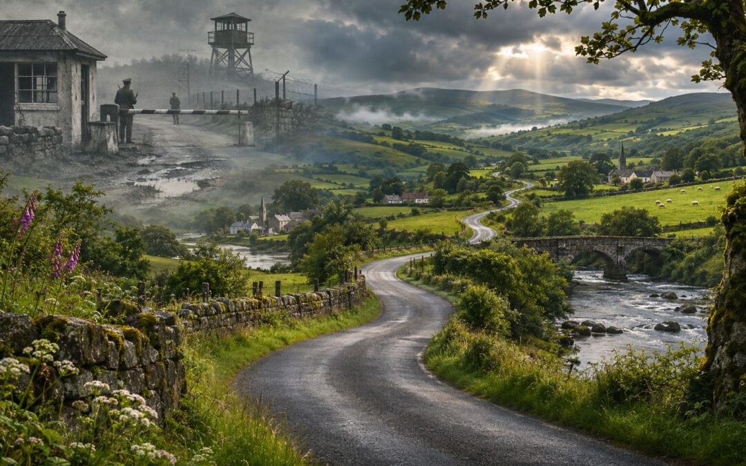
Drive from Clones in County Monaghan towards Cloverhill in County Cavan, and an ordinary journey through the Irish countryside can take you across an international border four times. There are no passport booths or armed guards announcing each crossing. You might notice the road markings changing, a speed-limit sign switching from kilometres to miles, or nothing at all.
A few decades ago, the same landscape looked very different. Customs officers inspected vehicles, soldiers watched the roads, and some rural crossings ended abruptly in craters or barricades. People living minutes apart could spend hours reaching one another. The border did not simply divide two governments: it interrupted farms, markets, churchgoing, family visits and the ordinary geography of community life.
The line between the Republic of Ireland and Northern Ireland runs for roughly 500 kilometres, following rivers, fields and old county boundaries. Northern Ireland belongs to the United Kingdom; the rest of the island forms an independent state. Yet neither the border nor the opposing identities associated with it emerged overnight. They were the outcome of centuries of political change, followed by decades in which the consequences of partition were felt most sharply by people who had little influence over the decisions.
The story sometimes called the Emerald Curtain is therefore not only about why Ireland was divided. It is about what happened when a boundary drawn on a map became a customs frontier, a smuggling opportunity, a military obstacle and, eventually, a largely invisible line again.
How Ireland Became a Divided Island
For most of its early history, Ireland was not a single centrally governed state. Gaelic kings ruled competing territories, Norse settlers established towns and trading networks, and Anglo-Norman nobles arrived in the twelfth century. English kings claimed authority over Ireland, but for centuries that claim extended much further than their effective control.
The foundations of the later conflict developed more clearly during the Tudor conquest. From the sixteenth century, English governments extended royal administration through military campaigns, negotiations and confiscations of land. The Reformation added a religious dimension: the English Crown embraced Protestantism while most of Ireland’s population remained Catholic. Political authority, land ownership and religion increasingly became entangled.
The plantations of the sixteenth and seventeenth centuries transformed the north in particular. Land taken from Irish lords was redistributed among settlers, including substantial numbers from England and Scotland. The Plantation of Ulster, begun in 1609, brought English Anglicans and Scottish Presbyterians into a region where Gaelic and Catholic communities already lived. It was not the settlement of an empty landscape, and the resulting disputes over property and political allegiance endured.
The rebellion that began in Ulster in October 1641 reflected Catholic grievances and fears about the future of their rights and estates. Violence against Protestant settlers, and later violence by several competing armies, deepened hostility. The rebellion became entangled with wider wars involving England, Scotland and Ireland; Oliver Cromwell’s conquest in the late 1640s and early 1650s caused further devastation and extensive Catholic dispossession.
The conflict between the Catholic James II and Protestant William of Orange later gave these divisions some of their most enduring symbols. The Siege of Derry in 1688–1689 and William’s victory at the Battle of the Boyne in 1690 became central episodes in Protestant and unionist historical memory. James’s defeat, confirmed by the end of the Williamite War in 1691, reinforced an unequal political order commonly known as the Protestant Ascendancy.
None of this means that Protestants and Catholics formed two uniform political camps. Presbyterians could resent Anglican privilege, some Catholics supported particular British governments, and social class divided every community. Over time, however, the overlapping histories of land, religion and political power helped produce different understandings of Ireland’s place in the British state.
The Acts of Union took effect in 1801, abolishing Ireland’s parliament and incorporating the island into the United Kingdom of Great Britain and Ireland. That decision followed the failed rebellion of 1798, when the United Irishmen had tried to build a movement across religious lines.
Then came the Great Famine of the 1840s. Potato blight destroyed the staple food on which many poor households depended, while poverty, land tenure, markets and British government policy shaped the scale of suffering. About a million people died and enormous numbers emigrated. The catastrophe strengthened grievances against British rule, although the path from famine to partition was neither direct nor inevitable.
By the late nineteenth century, two powerful constitutional aspirations had emerged. Irish nationalists increasingly sought self-government or independence; unionists, especially influential in northeastern Ulster, wanted to remain within the United Kingdom. Their collision would determine where the border appeared.
For the wider chronology, these developments belong within the history of Ireland. For the border’s story, their crucial consequence was that a population sharing one island had developed competing ideas about which state should govern it.
Home Rule, the Ulster Covenant and the Birth of Partition
The Home Rule movement proposed that Ireland should have a parliament responsible for domestic affairs while remaining in the United Kingdom. Charles Stewart Parnell made the question central to Westminster politics, but bills introduced in 1886 and 1893 failed. For many nationalists, Home Rule represented a constitutional route to Irish self-government rather than outright separation from Britain.
Many Ulster unionists viewed the proposal differently. An Irish parliament elected by an island-wide majority might, they feared, leave them politically vulnerable and weaken Belfast’s industrial and commercial ties to Britain. Their concerns involved British national identity, the economy and minority rights, as well as religious divisions. The opposition became more urgent when the Third Home Rule Bill was introduced in 1912.
On 28 September that year, unionists organised an extraordinary demonstration of resistance. Men signed the Ulster Solemn League and Covenant, and women signed a separate declaration pledging support for opposition to Home Rule. Together, the documents attracted 471,414 signatures. The Public Record Office of Northern Ireland’s digitised Ulster Covenant collection still preserves the names, making the scale of mobilisation visible through individual records.
Unionist leaders including Edward Carson demanded that Ulster should not be forced into an Irish parliament against its wishes. The Ulster Volunteer Force was established in 1913, and the Larne gun-running operation in April 1914 supplied arms for its supporters. Nationalists formed the Irish Volunteers in response.
But even the proposal to exclude Ulster raised another difficulty: the historic province contained nine counties, and its inhabitants did not agree uniformly. Many unionists were concentrated in the northeast, while nationalists formed substantial populations elsewhere. Simply calling the excluded area ‘Ulster’ would not answer where the boundary should run.
The Government of Ireland Act 1914 received royal assent, but the outbreak of the First World War suspended its operation. Many Irish men, unionist and nationalist, joined the British armed forces. Meanwhile, a revolutionary minority concluded that Ireland should become a republic rather than merely receive Home Rule.
That minority launched the Easter Rising in April 1916. Its leaders proclaimed an independent republic in Dublin but were defeated after a week of fighting. The executions that followed, together with arrests and wartime political developments, changed public opinion. In the December 1918 election, Sinn Féin displaced much of the older constitutional nationalist movement, while unionists retained substantial support in the northeast.
Sinn Féin representatives refused to sit at Westminster. Instead, they assembled the first Dáil in Dublin on 21 January 1919 and asserted Irish independence. The Irish Republican Army’s guerrilla campaign against British forces developed into the War of Independence. Britain’s government now faced a revolutionary movement demanding an independent state and a unionist movement determined not to be incorporated into it.
The response was the Government of Ireland Act 1920. Rather than one Home Rule parliament, it provided for two: a six-county Northern Ireland and a twenty-six-county Southern Ireland. The Linen Hall’s exhibition on creating the border explains how the six-county arrangement emerged from the political struggle over what territory unionists could reliably govern. Northern Ireland came into existence on 3 May 1921, although the proposed institutions in the south were rejected by the independence movement.
The Anglo-Irish Treaty signed in December 1921 ended the War of Independence and provided for the Irish Free State, a self-governing dominion within the British Empire. Northern Ireland was permitted to remain outside the new state, which it chose to do. The treaty confirmed arrangements around an existing partition; it did not create the original boundary. The House of Commons Library’s history of the Northern Ireland border makes that legal sequence explicit.
The settlement divided the independence movement. Michael Collins supported the treaty as a practical advance, while Éamon de Valera and other republicans rejected its constitutional compromises. The resulting Irish Civil War, fought between former allies in 1922–1923, devastated the new Free State. By the time the fighting ended, political authority on the island was already divided, although the exact future of the boundary remained contested.
The Border That Cut Through Farms, Roads and Villages
Northern Ireland comprised Antrim, Armagh, Down, Fermanagh, Londonderry and Tyrone. The other three Ulster counties—Donegal, Cavan and Monaghan—remained outside it. The choice gave unionists a safer majority than a nine-county arrangement would have offered, but it left substantial nationalist populations inside Northern Ireland. Fermanagh and Tyrone had Catholic majorities; large nationalist communities also lived in other counties.
The boundary was not drawn by someone designing a convenient frontier from scratch. It followed inherited county lines formed through older patterns of landholding, jurisdiction and geography. Those lines could trace rivers, cut across roads and pass through districts whose homes and markets were interconnected. A border that made political sense to its architects could look absurd at the level of a single farm.
Consider the roads around Clones in County Monaghan. A journey towards Cloverhill in County Cavan can cross the jurisdictional boundary repeatedly because the roads and the frontier do not run neatly together. Even when two destinations lie in the same state, the most natural road between them may pass through the other. A road built for local movement had become an international route by accident of political geography.
Landowners discovered comparable problems. One family’s home could lie on one side of the line while fields, livestock or outbuildings lay on the other. A shop might depend on customers from a neighbouring settlement now officially abroad. Families who had always visited one another using the shortest route faced new restrictions even though neither they nor their homes had moved.
In May and June 1922, before the Irish Civil War, clashes around Pettigo and Belleek involved republican forces, members of the new National Army, the Ulster Special Constabulary and regular British troops. British forces used artillery, and seven republican combatants were killed before republican units withdrew. The fighting showed how contested sovereignty could turn even a small border settlement into a military flashpoint.
The Anglo-Irish Treaty also provided for a Boundary Commission to consider changes to the frontier, taking account of local wishes alongside economic and geographical conditions. Many nationalists expected significant nationalist-majority areas in Northern Ireland to join the Free State. Unionist leaders opposed changes that might destabilise their new jurisdiction.
When the commission’s proposals became known in 1925, they disappointed those expecting a major territorial transfer. The recommendations involved adjustments in both directions, not a straightforward absorption of nationalist districts into the south. The British, Free State and Northern Irish governments ultimately agreed to retain the existing boundary in December 1925.
It was an important constitutional settlement but hardly a solution for the people whose ordinary movements crossed the line.
Customs, Butter and the Smuggling Economy
The border’s economic significance began in earnest on 1 April 1923, when customs controls were introduced between the Irish Free State and Northern Ireland. What had first been intended as an administrative boundary within the United Kingdom had become a frontier separating the new Free State from the UK, although both remained within the British imperial and Commonwealth constitutional world at that stage. Goods could no longer always move freely by the shortest route.
Customs officials monitored authorised crossings, inspected consignments and collected duties. There were exemptions and practical rules for particular farm products or personal belongings, but the basic change was dramatic. Merchants had to think about documentation, tariffs, permitted routes and opening hours. Farmers faced a bureaucracy that treated produce carried across a nearby field differently from the same produce sold to a neighbour on their own side.
The government could designate an approved road, but it could not erase all the unapproved paths. The frontier ran through a landscape full of lanes, tracks, rivers and fields known intimately to the people who lived there.
A much stronger incentive arrived with the Anglo-Irish Economic War of the 1930s. Éamon de Valera’s government withheld payments to Britain associated with earlier land-purchase loans, maintaining that the obligations should no longer apply. Britain responded with duties on Irish exports, especially agricultural products, and Ireland imposed retaliatory tariffs on British goods. Farmers were hit hard, but price differences also made crossing the border commercially attractive.
Cattle could be driven towards whichever market paid more; tea, flour, eggs, butter, footwear and household goods could be bought where they were cheaper. Smuggling might mean a large operation conducted for profit, but it could also mean an ordinary family quietly carrying something home without paying duty. People who did not think of themselves as criminals found that everyday shopping could now involve breaking customs rules.
Women became important participants in this informal economy, in part because of the way customs searches were organised. Male officers might suspect a woman was concealing food beneath her clothing but hesitate, or lack authority and appropriate staff, to search her. The imbalance between customs regulations and prevailing social conventions created a practical weakness that smugglers understood perfectly.
A striking example survives from Dundalk railway station. In 1940, an official complained about the urgent need for female searchers because women travelling by train openly challenged male customs officers to find the butter they claimed to be concealing. The scene illustrates gender and power as clearly as it illustrates smuggling.
The methods were inventive. Food disappeared into underwear, coats, prams and other apparently ordinary possessions. As described in an Irish Times review of the social history Unapproved Routes, a man in 1942 even disguised himself as a woman in a shawl while carrying an enormous bag of flour. Such stories are entertaining, but they also reveal how border rules gave ordinary people incentives to take unexpected risks.
Some of the most famous tales are harder to verify. There are accounts of customs officers inviting suspected smugglers to sit near a fire until hidden butter melted and ran down their legs. Another familiar story concerns a smuggler whose apparent load concealed the fact that the wheelbarrows themselves were the contraband. They are best understood as border folklore unless a particular episode can be independently established.
Other goods crossed the frontier because the two jurisdictions had different social regulations. Banned publications and contraceptives, alongside ordinary consumer products, appeared in accounts of illegal trade.
The Economic War ended with agreements in 1938, but customs checks and price differences survived. Smuggling could generate profits, supplement household income, or offer a way around rules residents considered intrusive. Some condemned the activity as lawbreaking, while others regarded it as a practical response to governments drawing an artificial line through a familiar community.
That mixture of inconvenience, ingenuity and informal resistance became part of the border’s social culture. When governments treated the frontier as a means of collecting revenue or protecting markets, local inhabitants treated it as something to navigate, evade or occasionally ignore. The contradiction would become far more dangerous once the border also became a security frontier.
Pettigo: The Village Split Between Two Countries
Pettigo makes the geography of partition unusually easy to understand. Much of the village is in County Donegal, in the Republic, while Tullyhommon on the other side of the Termon River lies in County Fermanagh, Northern Ireland. A bridge joins communities that share a local history but answer to different governments.
To someone studying a political map, the river offers a tidy boundary. To a resident, it can mean that a neighbour, shop or place of work on the other bank is subject to different taxation, policing, public services and rules.
Residents lived with administrative duplication. The divided community had separate policing and postal arrangements and customs facilities associated with the two jurisdictions. A small local settlement could seem to possess the institutions of two countries within a few minutes’ walk. What might be a minor inconvenience on one day could become a serious obstacle when restrictions tightened or crossings were closed.
Partition also produced a remarkable story about a house divided between jurisdictions. Travellers heard that a family could occupy rooms in Northern Ireland and others in the Republic, an arrangement that sounded like the sort of local legend invented to entertain visitors. Journalists from TheJournal.ie initially found residents who doubted the story, but later obtained historical information identifying the Murray family’s house at Gortineddan and showing doors associated with different sides of the boundary.
The investigation of that borderland house and its surrounding communities illustrates why it is dangerous to dismiss every strange border anecdote as fiction. A political line could pass through spaces people otherwise understood as one home.
The Second World War added another layer of complexity. Northern Ireland, as part of the United Kingdom, joined Britain’s war effort. Ireland remained neutral, describing the period domestically as the Emergency. The two jurisdictions consequently applied different wartime laws, supply arrangements and restrictions, even as people in Pettigo continued living side by side.
A person crossing the bridge could move from one jurisdiction participating in the war to another maintaining neutrality. Regulations involving security, lighting, rationing and the availability of goods were not identical. The contrast did not mean that neutral Ireland escaped hardship or wartime restrictions; it meant that neighbouring residents experienced those pressures under different authorities.
Belfast suffered devastating German air raids in 1941, while the government in Dublin maintained its policy of neutrality and provided assistance following the attacks. In border communities, the different wartime positions were less abstract. They could affect how a household obtained supplies, what restrictions applied to travel and which authorities enforced local rules.
Ireland’s constitutional separation from Britain developed further after the war. In 1949, the Republic of Ireland Act took effect, ending the remaining external role of the British monarch and confirming Ireland’s status outside the Commonwealth. The Free State had already acquired extensive independence in 1922, and the 1937 constitution had renamed the state; 1949 was another step in that evolution, not the beginning of independence.
For Pettigo, constitutional terminology mattered less than the fact that everyday life continued across the same bridge. People still had friends and relatives on the other side.
The Border Campaign and the Destruction of Rural Roads
In December 1956, the Irish Republican Army launched Operation Harvest, commonly called the Border Campaign. Its objective was to challenge Northern Ireland’s place within the United Kingdom through armed attacks, particularly against police stations, security installations and other symbols of state authority. It failed to produce the popular uprising its organisers hoped for, but it had a profound effect on the borderlands.
Northern Ireland’s authorities believed that minor crossings could help armed militants enter from the Republic, launch attacks and escape. Their response was to restrict routes considered difficult to police. On 21 December 1956, road closures began to be ordered, and British Army personnel subsequently helped make selected roads and bridges impassable.
Explosives created craters across rural roads. Bridges could be demolished, while other crossings were blocked with earth, concrete or heavy obstacles. When people found ways around these barriers, the authorities sometimes drove upright metal rails or spikes into the road. A lane once used to reach a neighbouring farm could turn into the broken edge of an international security barrier.
Those obstacles did not discriminate between an armed IRA unit and a resident driving to work. A farmer might be forced to travel many additional miles to reach land visible across a field. A shop lost customers whose usual route no longer existed. A family visiting relatives, a doctor making a journey or a parishioner attending church encountered the same inconvenience.
A contemporary complaint in the Fermanagh Herald described extra miles required for Sunday Mass. That detail is revealing because it gives the disruption a scale people could feel. For someone accustomed to walking or driving a short distance to worship, a security measure imposed on a remote road became a significant intrusion into a weekly routine and the social life surrounding it.
Local residents began organising road-repair groups. They filled holes with rubble, cleared obstructions and worked to restore connections between villages. Sometimes several people gathered with tools and machinery; at other times smaller groups quietly improvised an alternative route. Their actions were not necessarily endorsements of the IRA campaign. Many simply refused to accept the loss of roads essential to their livelihoods.
The authorities often returned to close the same crossing again. Residents then reopened it again. What one side saw as necessary security policy, the other experienced as an almost absurd contest over access to a familiar stretch of countryside. Each repetition could harden feelings and make cooperation with the security forces more difficult.
There were genuine dangers behind the restrictions. The IRA attacked police stations and other targets, and militants could use the border’s complicated geography to avoid pursuit. Security personnel faced the risk of being shot or bombed. Yet closing roads to hinder armed groups also punished whole communities and created new grievances among people who might otherwise have rejected the use of violence.
The campaign formally ended in 1962 without achieving reunification. A historical study of policing the Irish border explains why routes used by armed organisations were so hard to close completely. A security strategy that ignored the needs of border communities could undermine the very cooperation on which policing depended.
Derry, Civil Rights and the Beginning of the Troubles
By the 1960s, opposition to partition was only one source of discontent in Northern Ireland. Many Catholic and nationalist residents also argued that the political system discriminated against them in housing, employment, electoral representation and policing. They did not all agree about eventual reunification, but they increasingly demanded equal rights within the institutions governing their lives.
Voting rules need to be understood precisely. Northern Ireland’s parliamentary and local-government elections did not operate under identical arrangements. Property-related qualifications and other restrictions affected local elections, while local ward boundaries could translate electoral support into council representation in ways that favoured unionist control. It is inaccurate to claim that every property owner simply received multiple votes in every election.
Derry became the clearest illustration of the problem. Nationalists formed a majority of the city’s population, but electoral boundaries concentrated them in areas that elected fewer representatives. A unionist minority could consequently retain twelve seats on the twenty-member city council while nationalists held eight. To many residents, the numbers demonstrated that ordinary electoral participation could not produce government reflecting the local majority.
Housing decisions added a further grievance. Public housing allocation rested with authorities that were often controlled by unionists, and complaints of discriminatory treatment became increasingly prominent. Housing location also mattered electorally where residence affected local representation. A family waiting for a home was therefore caught in a system where housing, voting and political power reinforced one another.
The Northern Ireland Civil Rights Association and other activists demanded fair housing, equal voting arrangements, protection against discrimination and reforms to policing. Inspired partly by civil rights movements elsewhere, they organised marches and public demonstrations. Many participants sought peaceful reform, while opponents sometimes interpreted their campaigns as a concealed attempt to undermine the Union.
In October 1968, police violence against civil rights demonstrators in Derry drew wider attention to these grievances. Further marches, confrontations and attacks contributed to increasing tension.
On 12 August 1969, the Apprentice Boys’ annual procession passed close to the nationalist Bogside area of Derry. Hostile exchanges and stone-throwing developed into confrontation between residents and the Royal Ulster Constabulary. Police attempts to move into the Bogside were met by barricades, petrol bombs and prolonged resistance.
The resulting Battle of the Bogside lasted for roughly two days. Residents fought to prevent police entry, while the RUC employed armoured vehicles, water cannon and CS gas. What began in one city quickly became part of wider disturbances, including serious violence in Belfast, attacks on homes and the displacement of families.
British troops were deployed to Derry and Belfast on 14 August. Some Catholic neighbourhoods initially welcomed them as protection against violence; others viewed them with suspicion. The CAIN chronology of the conflict in 1969 records how the confrontations, civil rights demands and security responses developed into a much wider crisis.
The Battle of the Bogside was a defining escalation, not the single cause of the Troubles. The conflict drew on competing national identities, longstanding institutional grievances, reactions to civil rights activism, communal fear and the growing willingness of armed groups to use violence. These forces would transform the border from a difficult customs frontier into a heavily guarded and repeatedly attacked military landscape.
A Militarised Frontier: Watchtowers, Bombings and Road Repairs
From 1970, renewed security measures turned many border roads into contested territory. Authorities concentrated traffic through approved crossings, sometimes blocking or destroying the smaller lanes between them. Armed soldiers, police and customs officers guarded selected routes; armoured vehicles and helicopters patrolled others. Observation towers and reinforced checkpoints became visible reminders that the frontier was not only administrative but also military.
A driver could encounter a search, questions about a journey or a long wait at an authorised crossing. Elsewhere, a road simply ended in broken tarmac and a crater. The separation could become especially frustrating when a person could see a destination across the obstruction but had to take a much longer route to reach it legally by vehicle.
Security forces faced a real operational problem. Republican paramilitary groups crossed the frontier, attacked personnel and installations, and sometimes sought refuge in a different jurisdiction. The border’s shape and the number of lanes and tracks made consistent observation difficult. But the same geographical complexity supported ordinary social life: residents needed precisely those routes the authorities wanted to close.
A crossing designated for routine travel could be guarded by soldiers and customs staff, while a small local road might be blocked because it could not be supervised. An ‘unapproved’ road could still be the shortest way to reach a school, shop or relative.
People living on both sides repeatedly repaired the blocked routes. Some filled craters with soil and rubble; others moved concrete obstacles, cleared materials or constructed makeshift diversions. In some places whole groups gathered for repairs, including people whose only political demand was that their village not be cut in two. Security forces sometimes returned to demolish the newly restored road, and the cycle began again.
The Irish Times investigation Keeping the Peace describes the frustrated conclusions of a confidential British military study from 1989. The frontier remained difficult to close even after extensive spending and repeated operations because local inhabitants continued reopening their own roads. Far from being an incidental nuisance, their resistance was central to the authorities’ inability to control every crossing.
Statistics about closures are easily misleading. One historical account reports that about 90% of cross-border roads had been cratered or obstructed at some stage since the early 1970s. That does not mean 90% were closed simultaneously throughout the period. An Irish government security report from March 1976 recorded 114 of 219 actual cross-border roads closed at that point—52.1%—and acknowledged that reopening and reclosing made the position difficult to measure from day to day.
The authorities also sometimes used railway lines driven into the carriageway at an angle or concrete barriers that were harder to move than loose earth. Residents answered with makeshift repairs and organised campaigns to reopen routes. This was a struggle over more than convenience: it concerned who controlled movement through the spaces where people had lived and worked long before partition.
Customs posts were particularly vulnerable because they embodied the border in a tangible form. Some were robbed, burned, bombed or attacked at gunpoint.
At Belleek, attacks became so persistent that a customs post destroyed by explosives was replaced with a caravan, which was itself repeatedly burned or destroyed. A detailed report describes the replacement caravan being lost twelve times in two months. Officials eventually tried towing the vehicle away each evening, only for attackers to intercept it and burn both caravan and towing car. The story sounds almost farcical until one considers the danger to anyone required to work there.
That danger was real. On 22 August 1972, an IRA bomb exploded prematurely at the customs clearance office near Newry. According to the CAIN account of violence on the Irish border, nine people died: four customs officials, two civilian lorry drivers and three IRA members involved in planting the bomb. Whatever the intended warning or evacuation, an explosive device in an occupied workplace could kill people who had no role in the armed campaign.
Other attacks targeted soldiers, police officers and installations, while civilians suffered from shootings, intimidation and the danger of simply being in the wrong place. The wider Troubles killed more than 3,500 people, including civilians, members of the security forces and members of republican and loyalist paramilitary organisations. Families and communities lived with injury, bereavement and fear long after individual incidents disappeared from the news.
The Troubles also involved attacks in Belfast, Derry, the Republic and Great Britain, as well as disputes over internment, civil rights, political representation and state accountability. Bloody Sunday in Derry in January 1972, the collapse of devolved government that year and the hunger strikes of 1981 all shaped the wider political environment in which border security operated.
For residents, meanwhile, ordinary journeys could continue to be the most persistent reminder of the conflict. A damaged bridge prevented a convenient drive; a military search interrupted a delivery; a reopened road was destroyed again. The border’s supposed purpose was to distinguish jurisdictions, but in practice it repeatedly exposed how inseparable the surrounding communities remained.
How the Good Friday Agreement Made the Border Disappear
The gradual disappearance of the border’s most visible features required two different kinds of change: closer economic integration and political reconciliation. Neither would have been sufficient by itself.
Ireland and the United Kingdom both joined the European Economic Community in 1973. Their membership did not immediately erase customs controls, but it drew their economies into common European arrangements. A decisive change came on 1 January 1993 with the European Single Market, which removed the need for routine customs inspections between the two jurisdictions.
The removal of customs posts was not the end of the security frontier. The Troubles continued, and armed forces still patrolled routes or maintained installations associated with paramilitary threats. Ending those measures required a political settlement capable of accommodating people who disagreed profoundly about whether Northern Ireland should belong to the UK or a united Ireland.
After years of negotiations, ceasefires and setbacks, the Good Friday Agreement was reached on 10 April 1998. It accepted that Northern Ireland would remain part of the United Kingdom unless a majority voted for constitutional change, while recognising the legitimacy of peaceful aspirations for Irish unity. Rather than requiring one identity to defeat another, the settlement created institutions through which different communities could share political authority.
The text of the Belfast Agreement established power-sharing arrangements, provisions for north–south cooperation and commitments concerning rights and equality. It also recognised the right of people in Northern Ireland to identify as British, Irish or both. Voters endorsed the settlement in referendums, giving the compromise democratic legitimacy across the island.
The peace process was neither instantaneous nor irreversible. Political institutions faced suspensions, distrust persisted and paramilitary activity did not vanish completely. Weapons decommissioning and the removal of military infrastructure unfolded over time, as the security environment improved and governments pursued normalisation.
Yet the physical effect on the borderlands was profound. Watchtowers and barriers disappeared, roads were repaired and crossings that had been guarded or obstructed became ordinary routes again. Businesses could trade with neighbours without routine customs checks, while families no longer planned every journey around military installations.
One further distinction matters. The Common Travel Area between Britain and Ireland predates both countries’ membership of European institutions. It provides special reciprocal rights for British and Irish citizens to travel, live and work across the jurisdictions, alongside other entitlements. The Irish government’s explanation of the Common Travel Area makes clear that these arrangements are not dependent on EU membership.
The Common Travel Area was about people’s movement and associated rights. European integration helped remove commercial customs barriers, while the Good Friday Agreement and subsequent peace process allowed the dismantling of security barriers.
The line still existed on maps and in law. Different currencies, institutions, tax systems and political identities remained on either side. But a landscape once filled with military installations increasingly allowed residents to live as they had always needed to: connected to people and places across it.
Brexit and the Border That Would Not Stay Buried
For years after the Good Friday Agreement, the unobtrusive border appeared to be one of the peace process’s most practical achievements. Then the United Kingdom voted in June 2016 to leave the European Union. Northern Ireland voted by a majority to remain, but the UK-wide result determined its departure alongside Great Britain.
Leaving the EU Single Market and customs union created potential differences in tariffs, product standards, declarations and regulatory enforcement. A return to routine checks along hundreds of rural crossings could damage integrated communities and carry painful political symbolism.
One option would have been to introduce new customs infrastructure at the land frontier. But that carried serious difficulties. The border had more than 200 public road crossings, along with private lanes and other routes; policing all of them had proved difficult even at the height of the Troubles. Reintroducing barriers risked becoming a reminder of the division and coercion from which communities had spent decades trying to move away.
The Northern Ireland Protocol offered a different approach. Although Northern Ireland remained within the United Kingdom’s customs territory, it continued applying particular EU rules relating to goods, allowing trade across the island’s land boundary without routine customs declarations or physical checks. Some procedures instead applied to certain goods moving from Great Britain into Northern Ireland.
This solution avoided one set of problems while raising another. Many unionists worried that new checks across the Irish Sea created an economic distinction between Northern Ireland and the rest of the United Kingdom. Businesses also faced uncertainty about paperwork, supply chains and changing regulatory requirements. Nationalist and unionist politicians interpreted the arrangements differently, although individual opinions did not divide neatly by community.
The Protocol’s principal trading arrangements began operating in January 2021. Further negotiations produced the Windsor Framework, agreed in principle in February 2023 and adopted through EU–UK decisions the following month. The framework aimed to simplify procedures, particularly for goods destined to remain within Northern Ireland, while safeguarding EU trading rules and avoiding a hard land border.
The Irish Revenue guidance on trade with Northern Ireland explains the continued absence of customs checks on the island itself. The European Commission’s account of the Windsor Framework sets out how the agreed changes addressed difficulties with goods, medicines and other practical matters.
These arrangements did not settle every political disagreement. They reflected an enduring tension between maintaining Northern Ireland’s place in the United Kingdom, protecting trade across the island and preserving the peace settlement.
Today, a journey through Clones and the surrounding borderlands can once again feel like an ordinary drive. The road may cross a jurisdictional line four times, but nothing in the landscape demands four inspections. A political boundary remains, and debates about Irish reunification and British identity continue, but the practical experience is radically different from that of families confronted by customs posts, craters and soldiers.
That change is not proof that the border never mattered. It shows how deeply it mattered—and how much political effort was required to prevent it from determining every journey. The most lasting lesson of the Emerald Curtain may be that a border can be drawn by governments, but its daily consequences are borne by the people whose lives cross it.
Last Updated on November 7, 2026 by Aseem Gupta