
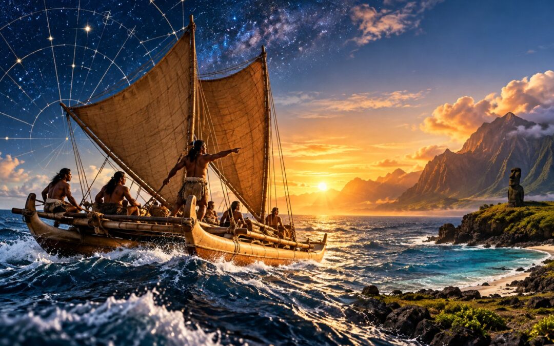
The Pacific Ocean covers approximately 160 million square kilometres, more than one-third of Earth’s surface. Scattered across this immense expanse are thousands of islands, many separated by hundreds or thousands of kilometres of open water. Some are large enough to support substantial populations, while others are tiny specks of land that would be extraordinarily difficult to locate without modern navigational instruments.
Yet long before European explorers crossed the Pacific, Polynesian voyagers had discovered and settled some of its most isolated islands. They travelled in wooden canoes, navigated without magnetic compasses or modern charts, and developed societies across an oceanic region of extraordinary geographical scale. Their achievements depended on sophisticated maritime technology, generations of accumulated knowledge, and an understanding of the natural environment that modern navigators have worked to recover.
One question has fascinated researchers for decades: Did Polynesian navigators travel far enough to reach the Americas before Christopher Columbus crossed the Atlantic in 1492?
For much of the twentieth century, the argument rested on competing theories about ocean currents, ancient boats, and the unexpected appearance of American crops in Polynesia. Experimental voyages demonstrated what prehistoric sailors might have accomplished, but they could not establish precisely what had happened.
More recently, genetic research has transformed the debate. The evidence now strongly supports contact between Polynesian and Native American populations before European arrival, although important questions remain about where those encounters occurred and who undertook the journeys.
Understanding that discovery begins with an even more remarkable story: how Polynesian navigators managed to cross and populate the Pacific in the first place.
How Polynesian Voyagers Populated the Pacific
Polynesia occupies an enormous region of the central and southern Pacific, conventionally represented by the Polynesian Triangle. Its northern corner is Hawaiʻi, its southwestern corner is Aotearoa (New Zealand), and its eastern corner is Rapa Nui (Easter Island). Within these boundaries lie island groups including Samoa, Tonga, the Cook Islands, Tahiti, the Marquesas, and numerous smaller communities.
Despite the distances separating them, Polynesian societies share important linguistic, cultural, and historical connections. Their languages belong to the Austronesian family, while their traditions preserve relationships involving ancestry, voyaging, social organization, and connections between communities. These similarities reflect a long history of movement and interaction across the ocean rather than the development of each island society in complete isolation.
The deeper origins of Polynesian settlement are generally traced through the expansion of Austronesian-speaking populations from East Asia into Island Southeast Asia and the Pacific. Taiwan features prominently in linguistic and archaeological reconstructions of this expansion, but the process was not a straightforward migration by one unchanged population. As voyagers moved through different regions, they interacted with existing communities, exchanged knowledge, and contributed to increasingly complex patterns of ancestry.
Archaeological evidence associated with the Lapita cultural tradition provides an important window into this history. Lapita communities are recognized partly through their distinctive decorated pottery, alongside evidence of seafaring, settlement, food production, and interaction among islands. Their expansion into Remote Oceania during the second millennium BCE established important foundations for later Polynesian societies, particularly in the region of Tonga and Samoa.
The later settlement of eastern Polynesia took place over many centuries. It involved journeys across increasingly large expanses of open water to islands that were sometimes far beyond sight of any previously inhabited land. These movements were part of the wider history of human migration and civilization, but they required maritime skills and knowledge systems developed specifically for the Pacific environment.
A 2021 genetic reconstruction of Polynesian migration examined genome-wide data from 430 individuals representing 21 Pacific island populations. Researchers identified a pattern of population expansion originating in Samoa and extending through island groups including the Cook Islands, Society Islands, Tuamotus, Marquesas, and Mangareva. Their model placed the settlement of Rapa Nui at approximately AD 1200, broadly consistent with important archaeological evidence.
This reconstruction also helped demonstrate that Polynesian expansion followed identifiable relationships between populations rather than an arbitrary scattering of people across the ocean. However, genetic models do not recover every voyage, and the precise settlement dates of particular islands remain subjects of investigation. Different forms of evidence can produce different chronological estimates, particularly where communities maintained contact after initial settlement.
What is clear is that the voyages did not simply end when land appeared on the horizon. Settlers had to establish sustainable communities, obtain food and water, cultivate crops, transport useful plants and animals where appropriate, and adapt their knowledge to unfamiliar environments.
The resulting societies developed distinctive cultures, political systems, religious traditions, and approaches to managing land and marine resources. Polynesian history is therefore not merely a story of discovering islands. It is the history of creating and sustaining communities across one of the largest inhabited maritime regions on Earth.
The Canoes That Made Long-Distance Voyages Possible
Navigating thousands of kilometres across the Pacific required vessels capable of surviving open-ocean conditions while carrying people, equipment, food, and water. The canoes developed by Pacific Islanders were sophisticated maritime technologies, refined through generations of practical experience rather than designed according to a single universal model.
One important innovation was the outrigger canoe. An outrigger consists of a smaller float connected to the main hull by supporting beams, providing additional stability. This design proved useful for fishing, coastal transportation, and voyages between islands, although different communities developed variations suited to their environments and purposes.
For long-distance journeys involving substantial crews and provisions, double-hulled voyaging canoes offered considerable advantages. Instead of attaching a smaller float to one side, builders connected two substantial hulls with crossbeams and constructed a working platform between them. The resulting vessel could provide greater stability and carrying capacity, making it possible to transport the supplies necessary for extended expeditions and settlement voyages.
The construction of these canoes demanded considerable technical knowledge. Where suitable trees were available, builders could shape hulls from large logs using adzes, tools designed for cutting and shaping wood. Other construction traditions involved joining wooden planks through carefully prepared lashings, allowing builders to produce vessels whose dimensions were not limited to a single tree trunk.
Plant materials played essential roles in construction and maintenance. Fibres obtained from coconut husks and other suitable plants could be twisted into strong cordage for securing structural components. Different woods were selected for hulls, supporting beams, and other parts, while plant resins, saps, and related materials could help protect or seal particular joints and surfaces.
These were not merely improvised boats assembled from whatever materials happened to be available. Their construction depended on knowledge of how wood behaved in seawater, how structural stresses affected lashings, and how to maintain a vessel exposed to waves, wind, and prolonged use.
Sails were equally important. Polynesian sailing traditions developed distinctive sail shapes and rigging arrangements that allowed crews to harness prevailing winds and adjust their course. A canoe’s ability to make progress across the ocean depended not simply on catching the wind but on coordinating its sails, steering, balance, and direction of travel.
Long voyages also required careful provisioning. Crews needed drinking water, food that could survive the journey, equipment for repairs, and sufficient space to work and rest. Coconut products were particularly useful in many Pacific societies because the plant supplied food, liquid, fibre, and construction materials, but coconut was not the only resource supporting voyaging.
The challenge became even greater when a canoe carried families or settlement groups rather than a small exploratory crew. Successfully founding a community required more than transporting people. Voyagers might also need useful plants, tools, and other resources that could help sustain life after arrival.
No single canoe design was used everywhere or throughout Polynesian history. Archaeological evidence, oral traditions, historical accounts, and surviving boatbuilding knowledge reveal regional differences and technological change over time. Modern reconstructions consequently provide valuable demonstrations of maritime capability without reproducing every detail of a particular prehistoric vessel.
The essential achievement was the integration of construction, seamanship, provisioning, and navigation into a functioning voyaging system. A seaworthy canoe made a long journey possible, but reaching a small island across an enormous ocean required another body of knowledge altogether.
How Polynesian Wayfinders Navigated Without Instruments
Imagine sailing hundreds of kilometres from the nearest visible land, with no compass, satellite navigation, or accurate modern chart. The horizon appears almost identical in every direction, while waves, clouds, and winds change continuously. Even if the destination is known, locating it requires maintaining a reliable sense of direction and distance over many days.
Polynesian navigators developed ways of meeting this challenge by reading patterns in the sky, ocean, and surrounding environment. Their knowledge was preserved through observation, training, oral traditions, and practical experience. Navigation was not a collection of isolated tricks but a system in which different signals helped navigators maintain and continuously revise their understanding of a voyage.
The stars provided one of the most important directional references. Because the Earth rotates, celestial bodies appear to move across the sky, rising in the east and setting in the west. Their rising and setting positions are predictable, allowing a knowledgeable navigator to use particular stars as directional guides.
A navigator could memorize the points along the horizon where useful stars appeared or disappeared. During the night, one star might guide a course for part of the journey before another became the more suitable reference. The system required familiarity with the seasonal visibility and apparent movement of celestial bodies rather than dependence on one permanently visible star.
The sun also supplied directional information during daylight, especially when its changing position was interpreted alongside the time of day and season. The moon and certain planets could provide additional references. None of these signals operated independently of the navigator’s accumulated understanding of the voyage.
Modern Hawaiian navigator Nainoa Thompson developed a particularly influential framework for organizing this information. The Hawaiian star compass described by the Polynesian Voyaging Society divides the horizon into 32 directional houses, each covering 11.25 degrees. These houses provide a mental framework for remembering where celestial bodies rise and set and how their positions relate to the desired course.
An important historical distinction is necessary here. Thompson’s 32-house system is a modern formalization developed through the revival of traditional navigation and influenced by knowledge transmitted by master navigators. It should not be treated as proof that every ancient Polynesian navigator used precisely the same 32-house arrangement.
The underlying principle, however, reflects a much older navigational achievement: the ability to understand direction through memorized relationships between the sky, the horizon, and the movement of a vessel.
Stars were most useful when the sky was clear. Clouds, rain, or changing conditions could make them difficult to observe, sometimes for extended periods. Polynesian wayfinders therefore relied on additional information supplied by the ocean itself.
Ocean swells are particularly valuable because they can preserve recognizable directions over considerable distances. A swell generated by weather systems far away may continue moving across the ocean even when the local wind changes. By observing how these movements interact with the canoe, an experienced navigator can identify a familiar directional pattern.
The motion of a canoe communicates information through the body as well as the eyes. A navigator who knows the expected direction of a swell can compare it with the way the vessel rocks, pitches, or meets the waves. Changes in that relationship may indicate that the canoe has moved away from its intended heading.
Multiple wave systems can complicate this task. Locally generated waves may cross larger ocean swells, creating a confusing surface pattern for an inexperienced observer. Skilled navigators learn to distinguish among these movements and identify the signals most useful for maintaining direction.
Winds and currents provide further information, although their value depends on geography and weather conditions. Persistent regional wind patterns can help sailors plan routes, while changing winds may require alterations in course or timing. Currents can assist movement, oppose it, or carry a vessel away from its intended track, making their effects important to understand.
A navigator also has to estimate how far the canoe has travelled. This involves combining observations of speed, direction, elapsed time, and changing environmental conditions into a continuously updated mental picture of the voyage. The objective is not simply to know which direction to sail at a particular moment, but to maintain an informed estimate of the canoe’s position relative to its departure point and destination.
Recognizing signs of approaching land was another essential skill. Certain seabirds return to land to rest or nest, and their flight patterns can provide useful information about nearby islands. The value of such observations depends on the species, time of day, and behaviour of the birds, since not every seabird remains close to shore.
Cloud formations can also reveal the presence of islands. High volcanic islands may influence local cloud development, while the colours of shallow lagoons and reefs can sometimes affect the appearance of clouds overhead. Changes in wave behaviour near reefs, floating vegetation, and other environmental signals may provide additional clues.
Individually, these signs can be misleading. A cloud does not guarantee land beneath it, and a bird flying in one direction does not necessarily identify the shortest route to an island. Their strength comes from combining several observations with knowledge of the route and the surrounding environment.
Voyage planning was therefore just as important as navigation at sea. Sailors could choose departure seasons and routes according to expected winds and currents, making a difficult crossing more manageable. One strategy discussed in historical interpretations involves sailing against prevailing conditions during exploration so that a return journey might benefit from more favourable winds or currents.
Such approaches are best understood as possible strategies shaped by local circumstances, not universal rules governing every Polynesian voyage. Oceanic conditions vary considerably, and there is no reason to assume that one method was suitable for all routes, seasons, or island groups.
The central achievement was the ability to combine knowledge of celestial movements, ocean conditions, environmental signs, and practical seamanship into a coherent method of travel. These techniques allowed navigators to undertake ambitious journeys while managing uncertainty rather than relying entirely on chance.
Kon-Tiki, Drift Voyages, and the Debate Over Intentional Settlement
By the twentieth century, researchers generally recognized important linguistic and cultural connections between Polynesian societies and populations farther west in Asia and the Pacific. Nevertheless, the extraordinary distances involved in settling remote islands encouraged competing theories about how these voyages had occurred.
One of the most controversial interpretations came from Norwegian explorer Thor Heyerdahl. He argued that people from South America had played a major role in the settlement of Polynesia, challenging the prevailing interpretation of an overwhelmingly west-to-east Austronesian expansion.
Heyerdahl emphasized the fact that winds and ocean currents could favour journeys from the South American coast toward parts of Polynesia. If a simple vessel could travel along these routes, he reasoned, prehistoric South Americans might have undertaken similar voyages.
Rather than presenting his argument only through historical interpretation, Heyerdahl decided to test the physical possibility of such a crossing.
On April 28, 1947, he and five companions departed from Callao, Peru, aboard Kon-Tiki, a raft constructed largely from balsa logs and other materials intended to approximate a traditional South American sailing vessel. The expedition travelled westward across the Pacific for 101 days before reaching Raroia in the Tuamotu Archipelago on August 7.
The journey captured international attention. Its success demonstrated that a vessel of relatively simple construction could survive a long Pacific crossing under favourable circumstances, and it became one of the best-known examples of experimental seafaring.
But demonstrating that a voyage is possible is not the same as establishing that it happened in prehistory.
The Kon-Tiki Museum’s account of the expedition recognizes this distinction. Heyerdahl’s raft demonstrated a viable journey from South America toward Polynesia, but its arrival did not establish that South Americans founded Polynesian societies or account for their languages, archaeology, and ancestry.
Those other forms of evidence continued to support the predominantly west-to-east settlement of Polynesia. The Kon-Tiki expedition therefore challenged assumptions about maritime possibility without overturning the broader account of Polynesian origins.
A different controversy emerged in 1956 when Andrew Sharp argued that accidental voyages and drifting could explain much of Polynesian settlement. According to this interpretation, sailors who became lost or were carried off course might have reached previously unknown islands without intending to discover them.
Accidental ocean journeys undoubtedly can occur. Storms, unexpected winds, navigational errors, and currents are capable of carrying vessels far from their intended destinations. The important question was whether such events could adequately explain the geographical distribution and enduring settlement of Polynesian communities.
Researchers began investigating this possibility through computer modelling. In 1973, Michael Levison, R. Gerard Ward, and John W. Webb published The Settlement of Polynesia: A Computer Simulation, exploring the likelihood that drifting vessels could have reached various islands under simulated conditions.
Their work challenged the adequacy of accidental drift as a general explanation for the settlement pattern, particularly for difficult destinations such as Hawaiʻi. However, simulations depend on assumptions about winds, currents, vessel behaviour, departure locations, and other variables. They cannot independently establish the intention behind every historical voyage.
The broader case for deliberate voyaging rests on several forms of evidence considered together. The distribution of related languages and material cultures, the movement of plants and technologies, the relationships among island populations, and the sophistication of inherited navigation systems all support a history in which purposeful travel played a central role.
Heyerdahl’s experiment and the drift debate asked whether people could cross vast stretches of the Pacific and whether they necessarily intended to do so. A later experiment would provide an especially powerful demonstration of how such intentional navigation could work.
Hōkūleʻa and the Revival of Pacific Wayfinding
During the twentieth century, many traditional Pacific navigational practices faced serious disruption. Colonial rule, changing transportation systems, and the declining everyday use of long-distance voyaging canoes had weakened the transmission of knowledge that earlier generations had maintained through direct instruction and experience.
In Hawaiʻi, this situation helped inspire an ambitious cultural and maritime project. Founded in 1973, the Polynesian Voyaging Society sought to demonstrate the capabilities of ancestral seafaring traditions while encouraging the recovery and continued practice of Indigenous navigational knowledge.
The result was Hōkūleʻa, a double-hulled voyaging canoe launched in 1975 and designed to undertake ocean crossings using non-instrument navigation.
Constructing a seaworthy canoe was only part of the challenge. The organizers also needed someone capable of navigating across the Pacific through traditional methods, without relying on modern instruments to determine the vessel’s position.
They turned to Mau Piailug, a master navigator from Satawal in Micronesia. Piailug had inherited and practised a sophisticated tradition of oceanic wayfinding, learning how to interpret stars, winds, waves, and environmental conditions through methods passed down within his community.
His participation was essential. Rather than merely reconstructing navigation from historical descriptions, the Hawaiian voyagers could learn from a master who possessed living practical knowledge of long-distance seafaring.
On May 1, 1976, Hōkūleʻa departed Hawaiʻi for Tahiti under Piailug’s navigation. The canoe travelled across more than 4,000 kilometres of ocean without using modern navigational instruments to guide its course.
After approximately a month at sea, Hōkūleʻa reached Mataiva on June 1. The crew continued to Tahiti, arriving in Papeʻete Harbour on June 4, where more than 17,000 people gathered to welcome the canoe.
The voyage was an extraordinary public demonstration of traditional wayfinding. It showed that a properly equipped crew, working with a capable canoe and sophisticated environmental knowledge, could intentionally navigate between distant Pacific islands.
The significance extended far beyond experimental archaeology. For many Pacific Islanders, Hōkūleʻa represented a renewed connection with ancestral achievement at a time when Indigenous cultures had often been portrayed as dependent on outside explanations for their own histories.
Piailug’s teaching helped make the revival possible, while Hawaiian navigators and educators developed the skills and institutions needed to carry that knowledge forward. Nainoa Thompson became one of the movement’s most influential navigators, combining rigorous study of celestial navigation with traditional learning to develop approaches that could be taught to new generations.
Hōkūleʻa subsequently undertook major voyages across the Pacific and beyond, including journeys that strengthened cultural connections among Polynesian communities. Its later circumnavigation of the world demonstrated how a vessel associated with ancestral voyaging could become a continuing expression of maritime heritage and environmental responsibility.
In March 2026, the Polynesian Voyaging Society commemorated the fiftieth anniversary of Hōkūleʻa’s maiden voyage to Tahiti, emphasizing both the achievement of the original crew and the enduring responsibility to transmit navigational knowledge.
The 1976 voyage did not prove every detail of prehistoric Polynesian settlement. A successful modern reconstruction cannot establish exactly when particular ancient canoes departed or which routes their crews followed.
It did, however, demonstrate that traditional wayfinding was practical, sophisticated, and capable of supporting deliberate ocean crossings. It also ensured that an important body of knowledge could continue to be practised rather than surviving only as a historical subject.
Having established what Polynesian navigators were capable of accomplishing, researchers could approach an even more difficult question: whether their journeys had extended beyond the known Polynesian islands to the American continent.
The Sweet Potato and Other Clues to American Contact
One of the most intriguing clues to possible contact between Polynesia and the Americas is an ordinary food crop: the sweet potato.
The domesticated sweet potato, Ipomoea batatas, originated in the Americas, where its cultivation has a long history. Yet sweet potatoes were also grown in parts of Polynesia before European explorers introduced American crops through the expanding global exchange networks that followed Columbus.
This raised an obvious question. How did a plant associated with the Americas become established on islands thousands of kilometres away before sustained European contact?
Archaeological research has identified sweet-potato remains in pre-European Polynesian contexts. Evidence from the Cook Islands, Hawaiʻi, and Aotearoa indicates that the crop was part of Polynesian agriculture before the period when Europeans began carrying American plants systematically around the world.
The most straightforward historical explanation appeared to be human transportation. Polynesian voyagers might have reached the American coast, obtained sweet potatoes through encounters or exchange with local communities, and carried the crop back across the Pacific. Alternatively, movement involving American voyagers might have introduced the plant into Polynesia.
The crop’s presence alone does not establish which scenario occurred. Nevertheless, it attracted considerable attention because Polynesian settlers were already known to transport useful plants when establishing new communities.
Linguistic similarities seemed to strengthen the possibility of contact. In several Polynesian languages, sweet potatoes are known by terms resembling kūmara, kumara, or kumala. Researchers have compared these words with terms found in Indigenous South American languages, including forms associated with Quechua and neighbouring linguistic traditions.
Such similarities can be meaningful because words sometimes travel with the objects or practices they describe. When communities exchange unfamiliar plants, animals, tools, or technologies, they may also adopt or adapt words associated with them.
However, linguistic evidence requires careful historical analysis. Similar sounds can occur by coincidence, while a word’s recorded form may have changed over time or been transmitted through intermediary populations. A convincing borrowing hypothesis therefore requires more than observing that two words resemble one another.
Botanical research introduced another complication: the possibility that sweet potatoes or their ancestors reached Polynesia through natural dispersal before humans settled the region.
A 2018 study in Current Biology examining sweet-potato evolution and dispersal used genetic information from sweet potatoes and related species to reconstruct their evolutionary history. Its researchers proposed that long-distance natural dispersal could explain the plant’s presence in Polynesia without requiring prehistoric human transportation from the Americas.
The hypothesis challenged the assumption that an American plant in Polynesia must necessarily have arrived through a human voyage. Plant material can sometimes travel across long distances through processes involving water, floating debris, animals, or other environmental mechanisms, although the precise feasibility depends heavily on the species and circumstances involved.
The study did not establish that every cultivated sweet potato found in prehistoric Polynesian contexts had arrived without human assistance. Rather, it demonstrated why plant distribution and the history of human contact are related but distinct scientific questions.
Other biological clues have generated similar debates. Bottle gourds, useful for containers and other purposes, were known in both the Americas and the Pacific, but their dispersal history is complicated by the possibility of natural oceanic transport and movements through other regions.
Chicken remains reported from an archaeological site in Chile also attracted attention because some researchers interpreted them as possible evidence that Polynesian chickens had reached South America before Europeans. Subsequent work challenged aspects of the dating and genetic interpretations, leaving the claims disputed rather than established.
These examples illustrate an important limitation of archaeological reasoning. A plant or animal appearing on both sides of an ocean may suggest contact, but explaining how it arrived requires evidence about chronology, species history, environmental dispersal, and human activity.
The sweet potato remains historically significant because its pre-European cultivation in Polynesia is well supported and its American connections raise a genuine question. Yet its dispersal history is not sufficiently straightforward to establish the direction and date of a particular voyage.
For much of the twentieth century, researchers had to assemble the contact hypothesis from such indirect clues. The possibility was compelling, especially given the demonstrated capabilities of Polynesian navigation, but the evidence remained open to competing interpretations.
Population genetics eventually provided a more direct way to investigate whether Polynesian and Native American peoples had actually encountered one another.
What Genetic Evidence Reveals About Pre-Columbian Contact
The genetic question is fundamentally different from asking whether a canoe could cross the Pacific or whether a particular crop might have been transported by people.
When populations with different ancestry histories have children together, their descendants inherit genetic material from both groups. Over subsequent generations, recombination breaks inherited DNA into increasingly smaller segments. By examining those patterns, researchers can sometimes identify historical population contact and estimate when it occurred.
This method has limitations. Genetic dating produces estimates rather than precise historical dates, while ancestry signals must be distinguished from later population movements. Nevertheless, genomic evidence can reveal relationships that archaeological finds or historical accounts have not directly preserved.
Rapa Nui became a particularly important location for investigating this question. Its position at the eastern edge of Polynesia places it closer to South America than many other Polynesian islands, although the distance to the mainland remains approximately 3,700 kilometres.
Archaeological and genetic evidence establishes the Polynesian origins of the island’s Indigenous population. The controversy concerned whether those people, or their ancestors elsewhere in Polynesia, had encountered Native Americans before European contact with Rapa Nui in 1722.
An important breakthrough appeared in 2014 when researchers published genome-wide findings from 27 Rapanui individuals in Current Biology. The analysis identified predominantly Polynesian ancestry alongside Native American and European genetic contributions.
By examining ancestry patterns in eight unrelated individuals, the researchers estimated that Native American admixture had occurred between approximately AD 1280 and 1495. The inferred date was considerably earlier than European arrival at Rapa Nui, suggesting one or more episodes of pre-European trans-Pacific contact.
The findings were important, but they were based on people living long after the presumed encounter. Later migrations, complex ancestry histories, and assumptions involved in genetic dating made independent confirmation desirable.
In 2017, another study complicated the picture. Researchers examined low-coverage genomic data from five historical Rapanui individuals, including remains dating before and after European contact. They detected Polynesian ancestry but did not find substantial Native American ancestry in their samples.
The researchers suggested that the Native American ancestry observed in present-day Rapanui might reflect more recent historical interactions. Their findings appeared to conflict with the earlier interpretation and demonstrated why the timing of contact could not be treated as settled.
However, five individuals cannot represent the complete ancestry history of an island population. The genomes in that study also provided limited genetic coverage, restricting the ability to detect smaller ancestry contributions. An absence of detectable admixture in a small sample is not automatically proof that admixture never occurred elsewhere in the population.
A much larger investigation followed in 2020.
Published in Nature, the study Native American Gene Flow into Polynesia Predating Easter Island Settlement examined genome-wide variation from 807 individuals representing 17 Polynesian island populations and 15 Native American groups from the Pacific coast.
The researchers identified genetic patterns consistent with prehistoric contact between Polynesian and Native American populations around AD 1200. Their analysis suggested that an important encounter occurred in eastern Polynesia, before the settlement of Rapa Nui, with a Native American population most closely related to Indigenous peoples of present-day Colombia.
This was a significant development because the evidence was not limited to the inhabitants of Rapa Nui. Native American ancestry signals were found in populations from several eastern Polynesian islands, suggesting that contact had occurred within a wider network of Polynesian migration and interaction.
The proposed chronology was especially interesting. Around the same broad period, Polynesian voyagers were expanding into increasingly distant parts of eastern Polynesia, establishing communities and maintaining connections between island groups.
The findings made prehistoric contact considerably harder to dismiss as an interpretation based solely on ambiguous crops or linguistic similarities. They also suggested that any encounter could have occurred before the settlement of Rapa Nui, with the resulting ancestry spreading through later Polynesian population movements.
Nevertheless, the 2020 study did not identify a particular canoe, voyage, meeting place, or individual group of sailors. Its conclusions relied on statistical reconstruction of ancestry and population relationships, not direct historical observations.
Researchers could estimate when ancestry entered a population and identify affinities with present-day or historically sampled groups. They could not establish from those data alone whether Polynesians reached South America, Native Americans travelled to Polynesia, or contact involved journeys in both directions.
Another major discovery arrived in 2024.
A study published in Nature, Ancient Rapanui Genomes Reveal Resilience and Pre-European Contact with the Americas, examined whole-genome data from 15 historical Rapanui individuals. The researchers radiocarbon-dated their remains to periods between approximately AD 1670 and 1950 and compared their genetic ancestry with other populations.
The results demonstrated that the sampled individuals were Polynesian in origin and closely related to present-day Rapanui. Importantly, they also carried Native American ancestry, amounting to approximately 10% of their genomes, comparable with levels observed in modern Rapanui populations.
Using genetic patterns alongside radiocarbon information, the researchers estimated that the ancestry mixture had occurred around AD 1250–1430, before sustained European contact.
A critical distinction matters here. The human remains were not all from the pre-European period, and the study did not recover a person known to have participated in a prehistoric encounter. Instead, the researchers used the historical genomes to reconstruct an earlier admixture event.
That difference does not invalidate the finding. Genetic segments can preserve information about ancestry from generations before the people whose remains are analysed. By examining the structure of those segments and estimating how recombination changed them over time, researchers can investigate historical mixing events.
The 2024 results strengthened the case for prehistoric contact by providing genetic evidence from historical remains rather than relying solely on present-day populations. They also reduced the plausibility of explanations that placed all Native American ancestry in Rapa Nui after European arrival.
Together, the studies published in 2014, 2020, and 2024 have significantly changed the scientific discussion. What was once an intriguing possibility supported mainly by indirect clues is now backed by multiple lines of genetic evidence indicating pre-European interaction between Polynesian and Native American populations.
The findings do not eliminate every uncertainty. Different analyses produce somewhat different dates, and researchers continue examining population histories, sampling limitations, and the geographical origins of ancestry signals.
The stronger conclusion is that pre-Columbian contact between Polynesian and Native American peoples is supported by substantial genetic evidence. The more specific historical questions—who crossed the ocean, where they met, how frequently contact occurred, and what was exchanged—remain more difficult to answer.
Did Polynesians Reach America? What Is Established and What Remains Uncertain
The original question can now be separated into several parts, each requiring a different level of confidence.
First, there is little serious doubt that Polynesian societies developed extraordinary long-distance navigational capabilities. Archaeological evidence establishes the settlement of remote Pacific islands, while linguistic and genetic research connects those communities through broader histories of movement. Traditional wayfinding knowledge and experimental voyages such as Hōkūleʻa demonstrate that deliberate navigation without modern instruments was entirely practical.
Second, the evidence strongly supports contact between Polynesian and Native American populations before European arrival. The 2020 and 2024 genetic findings provide particularly important support, extending the argument beyond archaeological clues involving plants and animals.
Third, the precise direction of contact remains uncertain.
One plausible scenario involves Polynesian voyagers travelling eastward during the expansion of eastern Polynesia, reaching the American coast, interacting with local communities, and eventually returning. Their maritime capabilities and the chronology suggested by population genetics are consistent with such a possibility.
Another scenario involves Native American voyagers travelling westward and encountering Polynesian communities in the Pacific. Heyerdahl’s Kon-Tiki expedition showed that currents and winds could support an east-to-west crossing, although the experiment did not establish that a particular prehistoric encounter occurred through this route.
More complicated histories are also possible. Contact might have involved multiple journeys, different groups, or interactions that occurred over time rather than through one dramatic expedition. Genetic analyses can identify ancestry connections without necessarily determining how many separate voyages contributed to them.
The geographical location of the encounter is similarly unresolved. The 2020 study’s findings point toward contact in eastern Polynesia before the settlement of Rapa Nui, while genetic affinities link the Native American contribution to populations related to those in present-day Colombia. These observations narrow the historical possibilities but do not identify a particular landing site.
The evidence must also be interpreted without reviving Heyerdahl’s broader theory that South Americans were principally responsible for settling Polynesia.
That hypothesis is not supported by the combined linguistic, archaeological, and genetic record. Polynesian societies emerged through the history of Austronesian-speaking populations and their interactions across the western and central Pacific. The presence of Native American ancestry indicates contact and population mixing, not that the fundamental origins of Polynesian civilization lay in South America.
Nor should the question be framed as a competition over who deserves recognition for discovering a continent. The Americas were already inhabited by Indigenous societies with their own long and complex histories. Possible Polynesian voyages to their shores would represent encounters between existing populations, not the discovery of an empty world.
Columbus’s 1492 voyage remains historically consequential because it initiated sustained European expansion and increasingly permanent connections across the Atlantic. Earlier Polynesian–American contact belongs to a different history, one in which oceanic mobility, exchange, and human interaction developed through networks that European observers did not create.
The most defensible conclusion is therefore more precise than a simple yes or no. The evidence strongly supports prehistoric contact between Polynesian and Native American peoples, and Polynesian voyages to the Americas are a plausible explanation. What remains unproven is the exact sequence of journeys through which those encounters occurred.
The achievement of Polynesian navigation does not depend on resolving every detail of that final question.
Across centuries, Polynesian voyagers crossed immense stretches of open water, settled remote islands, transported knowledge and resources, and established societies adapted to environments scattered across the Pacific. Their accomplishments relied on technological skill, environmental understanding, cooperation, and the careful transmission of expertise from one generation to the next.
The voyages of Hōkūleʻa restored public recognition to traditions that had never been merely theoretical, while archaeology and genetics have helped clarify the deeper history of the people who practised them. The evidence for contact with the Americas adds another important dimension to that story without replacing its central significance.
The Pacific was never simply an empty expanse separating isolated islands. For its Indigenous navigators, it was a navigable environment whose winds, stars, waves, and living patterns could guide journeys across extraordinary distances. The remaining mysteries concern the precise paths people followed, not whether they possessed the knowledge and capability to make such journeys.
Last Updated on October 29, 2026 by Aseem Gupta