
Reading Time: 30 Minutes
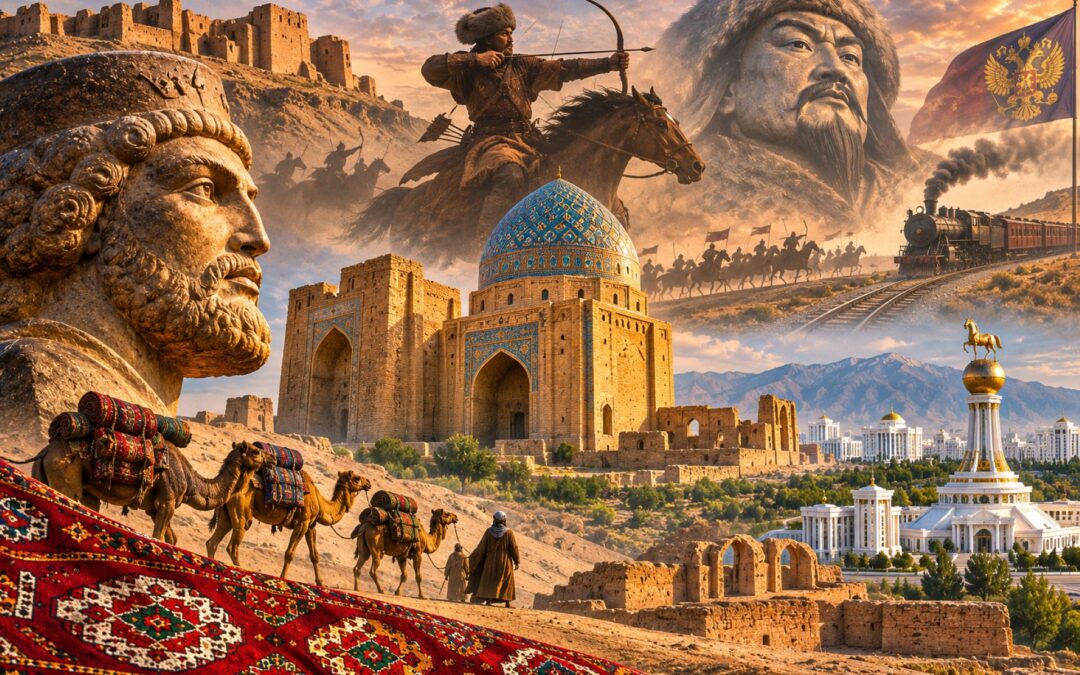
Turkmenistan is often introduced through the peculiarities of its modern government: white-marble monuments, presidential personality cults and one of the world’s most tightly controlled political systems. Yet long before there was a country called Turkmenistan, the land within its present borders contained farming villages thousands of years old, a powerful capital of the Parthian Empire and one of the great intellectual and commercial cities of the medieval world.
Its history is not simply a succession of conquerors crossing an empty desert. The Karakum Desert made settlement difficult, but rivers and mountain foothills sustained communities that connected Iran, the Eurasian steppe, India and China. Those connections brought prosperity, migration, religious change and devastating warfare. They also made control of water, trade routes and fertile oases central to political power.
The modern Turkmen people emerged much later than the earliest civilizations on this land. Their Oghuz Turkic heritage developed through centuries of migration and interaction with earlier inhabitants, while today’s national borders were largely established during the Soviet period. Understanding the country’s past means following those different histories without pretending that ancient Persians, Parthians and medieval Turkmen all belonged to one continuous modern nation.
The result is a history in which familiar borders repeatedly disappear, but the communities and landscapes beneath them remain. To follow it, the most useful starting point is not a king or an empire, but the first farmers who learned to survive at the desert’s edge.
The First Farmers and Cities of the Desert
The most influential feature of Turkmenistan’s geography is the Karakum Desert, which occupies most of the country. Much of the landscape receives too little rainfall for ordinary agriculture, and temperatures can be extreme. But the desert is not a uniform expanse of lifeless sand. Rivers descending from mountains and highlands, underground water and fertile strips along the Kopet Dag foothills have sustained human communities for millennia.
Around 6000 BCE, people were cultivating grain and raising animals at Jeitun, a settlement near the foothills northeast of present-day Ashgabat. Archaeologists have uncovered small mudbrick buildings, carefully prepared floors, pottery, stone tools and evidence of domestic animals. Charred remains of barley and wheat help establish that the inhabitants were practicing agriculture rather than depending entirely on hunting and gathering.
The archaeological excavations at Jeitun are particularly significant because they document some of the earliest known farming communities in Central Asia. They do not prove that agriculture first originated there; the cultivation of domestic crops had begun earlier in Southwest Asia. Instead, Jeitun helps explain how agricultural knowledge, animals and settled village life spread eastward into very different environments.
Life in these villages combined several ways of obtaining food. Sheep and goats provided meat and other products, farmers cultivated cereals, and hunting remained useful. The residents built and repaired houses using locally available earth, while their stone blades and grinding equipment suggest the repetitive labour required to harvest, process and store grain.
The archaeological evidence also complicates the idea that early farming villages immediately became large, permanent towns. Individual buildings changed over time, and some phases of occupation may have been seasonal. Settlement patterns followed available water and workable land, conditions that could change even when the wider climate remained broadly similar.
Over the following millennia, communities expanded along the southern foothills and into the river systems of the region. Sites such as Anau and Namazga Depe reveal increasingly complex settlements, specialized crafts and connections with societies farther west and south. Pottery, metalworking and architectural remains suggest that the region was participating in wider technological and commercial developments during the Copper and Bronze Ages.
One of the most remarkable developments occurred in the Murghab River delta, where water from the mountains of today’s Afghanistan spread across the desert. During the Bronze Age, an extensive oasis civilization developed in the region historically known as Margiana. Its settlements were connected through irrigation, cultivation, crafts and exchange with neighbouring parts of Central Asia, Iran and Afghanistan.
At Gonur Depe, archaeologists have uncovered monumental buildings, fortified compounds, elaborate burials, precious objects and spaces interpreted by some researchers as religious complexes. The Soviet and later Russian archaeologist Viktor Sarianidi began exploring the site in the 1970s and spent decades excavating what became one of the major discoveries of Central Asian archaeology.
The material belongs to the broader archaeological world often called the Bactria–Margiana Archaeological Complex, or Oxus civilization. Its inhabitants participated in long-distance exchanges and developed sophisticated forms of urban organization. Sarianidi proposed connections between certain fire-related structures and early Zoroastrian religious practice, but the identification remains disputed; the presence of hearths and ritual objects does not by itself establish the beliefs of their users.
At sites across this cultural region, imported materials and distinctive artifacts suggest links to the Indus civilization, the Iranian plateau and settlements farther north. Such objects help reveal networks of exchange, but not the language or ethnicity of the people who produced them. Archaeological cultures are analytical categories, not ancient nations with fixed borders.
The Murghab’s shifting channels also made these settlements vulnerable. As waterways changed course and irrigation networks required maintenance, communities sometimes moved toward more dependable supplies. There was no single moment when every Bronze Age settlement was abandoned because a river suddenly disappeared. Rather, environmental change and human decisions gradually altered the geography of habitation.
That recurring relationship between water and settlement helps explain why cities repeatedly emerged, declined and reappeared at different points within the same oasis. Later rulers would inherit a landscape where prosperity depended on irrigation systems developed over generations, and where losing control of those systems could have catastrophic consequences.
Persians, Greeks and the Rise of Parthia
By the first millennium BCE, the oases of southern Central Asia were connected to the kingdoms and imperial networks of the Iranian world. Different communities occupied the fertile settlements, mountain fringes and steppe, and their relationships cannot be reduced to one ethnic identity. Iranian-speaking populations were especially influential, while mobile pastoralists maintained connections across the wider region.
During the sixth century BCE, much of what is now Turkmenistan came under the Achaemenid Persian Empire. The empire founded by Cyrus the Great and expanded by his successors governed a vast territory stretching from the eastern Mediterranean toward the Indus. Margiana, the oasis region around Merv, formed part of this imperial world.
The Behistun inscription of Darius I records a rebellion in Margiana during the crisis surrounding his accession to power. Its appearance in a royal account of imperial suppression shows that this supposedly remote region mattered politically to rulers based far to the west. The Persians relied on provincial administration, tribute and communication routes to maintain authority over territories separated by enormous distances.
Imperial rule did not eliminate local traditions. Settlements continued agricultural production and exchanged goods with neighbouring regions, while the relationship between settled communities and pastoral populations remained important. The desert both limited central control and made productive oases valuable prizes.
Achaemenid administration depended upon the movement of officials, messengers and military forces along long-distance routes. Local elites could retain influence within imperial structures, even when royal inscriptions represented their submission as straightforward. In such frontier regions, the distinction between direct rule, tribute and negotiated loyalty was often less clear than a modern political map suggests.
In the fourth century BCE, Alexander the Great defeated the Achaemenid Empire and pushed his campaigns into Central Asia. His conquest brought the region into contact with Macedonian military power and the wider Hellenistic world. But Alexander died in 323 BCE, leaving his generals to struggle over the immense territories he had acquired.
Much of the area passed to the Seleucid Empire. The Seleucid ruler Antiochus I was associated with the development or refounding of the city known as Antiochia in Margiana, part of the historical complex that later became Merv. Greek cultural and political influences joined an already established Iranian and Central Asian environment rather than replacing it wholesale.
Seleucid authority in the eastern territories weakened during the third century BCE. Among the peoples taking advantage of that weakness were the Parni, a group associated with the wider Dahae tribal confederation. Their leader Arsaces established the ruling line of what became the Parthian, or Arsacid, Empire.
One of the dynasty’s earliest and most important centres was Nisa, near present-day Ashgabat. The remains of Old and New Nisa include fortified complexes, architectural fragments and objects demonstrating the interaction of Iranian traditions with Hellenistic artistic forms. The Parthian Fortresses of Nisa are now recognized by UNESCO for their importance to the history of an empire that linked the Mediterranean and Central Asian worlds.
Archaeologists have recovered decorative ivory rhytons, or ceremonial drinking vessels, alongside sculpture, inscriptions and evidence of monumental construction. These objects are reminders that the Parthians were more than a military power. Their rulers supported courts and administrative centres that drew upon multiple cultural traditions.
The Parthian Empire eventually expanded across Iran and Mesopotamia, becoming Rome’s most formidable eastern rival. Its cavalry was particularly effective in open country, combining heavily armoured horsemen with mobile mounted archers. The ability to strike from a distance, retreat and reorganize could frustrate armies accustomed to different forms of warfare.
That advantage became famous at the Battle of Carrhae in 53 BCE. Marcus Licinius Crassus, one of Rome’s richest and most powerful men, invaded Parthian territory seeking military prestige. Near Carrhae, in what is now southeastern Turkey, his forces confronted a Parthian army commanded by Surena.
The Parthians harassed Roman formations with mounted archers, repeatedly withdrew from attempted counterattacks and used a supply of arrows carried on camels to sustain their pressure. The Roman army suffered a disastrous defeat, and Crassus was killed. The celebrated manoeuvre of firing backward while riding away became known as the Parthian shot, although the popular association with the English expression ‘parting shot’ is not a reliable guide to the phrase’s linguistic origin.
Carrhae was fought well beyond the borders of modern Turkmenistan. Its connection to the country’s history lies in the early Parthian centres near Nisa and the wider imperial expansion that followed. The battle demonstrated the military strength of a dynasty whose formative history included the southern Central Asian frontier.
Parthian rule lasted until the early third century CE, when the Sasanian Persian dynasty replaced the Arsacids. The oases of present-day Turkmenistan remained part of a larger political and cultural zone, now shaped by Sasanian administration and continuing exchanges across the Iranian plateau and Central Asia.
Merv and the Silk Road World
The history of Merv captures the importance of the Turkmenistan region more clearly than any single monument. Situated within the Murghab oasis, the city developed where water, cultivated land and routes across Central Asia intersected. It was neither an isolated desert settlement nor merely a stopover where passing caravans briefly rested.
What people call the Silk Road was not one continuous highway running directly from China to Rome. It was a shifting network of routes, merchants, markets and local connections linking East Asia with India, Iran, the steppe and the Mediterranean. Merv’s position allowed it to participate in several branches of that network and to profit from the movement of goods, travellers and ideas.
The oasis supported more than merchants and warehouses. Its irrigated fields produced food for urban residents, travelling groups and surrounding communities, while local industries and services sustained people who worked far beyond the caravan trade. Its political importance reflected the combination of agricultural resources, transport links and administrative functions.
The routes passing through Khurasan also connected armies and governments. A city that could provision merchants could help provision soldiers, and a city capable of collecting duties could become an important source of revenue. Control of Merv therefore mattered to empires seeking both trade and authority over their eastern territories.
The archaeological landscape of Ancient Merv preserves the physical record of successive cities built near one another over roughly four thousand years. Among the most important surviving areas are the ancient citadel of Erk Kala, the larger enclosure of Gyaur Kala and the later medieval city of Sultan Kala. They were not all founded at the same time or occupied in identical ways.
The movement of urban activity between these areas reflects changes in power, irrigation and settlement over centuries. Because many later towns developed beside rather than directly over earlier ones, archaeologists can still examine extensive fortifications, street plans and abandoned buildings. The ruins help reconstruct a complex sequence of cities rather than the rise and fall of one unchanging urban centre.
Different districts also preserve evidence of the practical infrastructure that supported desert life. Cisterns and water systems served urban households and institutions, while fortified residences and large enclosures reveal changing ideas of security. Such structures remind us that spectacular monuments were sustained by ordinary systems of labour, agricultural production and maintenance.
Under the Seleucids and later the Parthians and Sasanians, Merv participated in political networks stretching across Iran and beyond. Its location near the eastern edge of several empires made it strategically valuable as a place from which rulers could supervise frontier territories, provision troops and communicate with neighbouring regions.
Its communities were also religiously diverse. Archaeological and historical evidence points to Zoroastrian practices, Buddhist institutions and Christian communities, alongside other traditions and the beliefs of travellers and merchants. The remains of a Buddhist monastery and stupa within the Merv complex are a particularly striking reminder that the religious geography of Central Asia once differed greatly from its present appearance.
Christianity also travelled east along the commercial and cultural networks linking Mesopotamia with Central Asia. Communities associated with the Church of the East developed across the region, illustrating how religious ideas moved with merchants, scholars and migrants. Jewish merchants and communities likewise formed part of the broader interconnected world, although the composition of Merv’s population changed substantially over time.
This diversity was not evidence that every community enjoyed constant harmony. Imperial warfare, sectarian competition and changing political circumstances could disrupt coexistence. Yet the city’s historical record makes clear that it belonged to a plural and interconnected world rather than a culturally sealed society.
Merv’s importance continued after the fall of the Sasanian Empire. Under Muslim rule it became a major administrative centre of Khurasan, and later rulers invested in buildings, markets and religious institutions. Its greatest urban expansion occurred under the Seljuks, but the foundations of that achievement had been laid by many centuries of oasis agriculture and international connections.
At its medieval height, Merv possessed extensive city walls, monumental architecture, numerous religious and educational institutions and a reputation for scholarship. Writers celebrated its wealth and learning, while travellers described an extraordinary collection of libraries. Population estimates vary considerably, and claims that Merv was definitively the world’s largest city cannot be established with precision.
What is beyond doubt is that Merv became one of the most significant urban centres of its age. Its rise illustrates how a city at the edge of a desert could flourish when river systems, political stability, investment and commercial networks reinforced one another. That prosperity would eventually make its destruction especially consequential.
Islam, the Abbasids and the Seljuk Empire
The seventh century transformed the political and religious landscape of the region. As Arab Muslim armies defeated the Sasanian Empire and advanced into Khurasan, Merv became part of an expanding Islamic world. The transition was neither instantaneous nor a simple replacement of one population by another: older religious communities survived, local elites negotiated new arrangements and conversion to Islam unfolded over generations.
The last Sasanian ruler, Yazdegerd III, fled east as his empire collapsed. He reached the area around Merv in 651 and died there under circumstances later chroniclers described in different ways. One tradition tells of a miller who killed the fugitive king for his possessions, but the details cannot be established with certainty. What is clear is that his death symbolized the end of Sasanian imperial rule.
Merv became an important garrison and administrative centre under the Arab caliphate. Muslim settlers and soldiers joined a population already shaped by Iranian, Central Asian and other traditions. The region’s wealth, distance from the caliphal centre and complex local politics made it both an asset and a potential source of rebellion.
During the Umayyad period, tensions developed among Arab tribal groups and between the ruling establishment and various disaffected communities. Political grievances mixed with disputes over taxation, status and the treatment of non-Arab converts to Islam. Those conflicts helped make Khurasan an important centre of resistance to Umayyad rule.
In 747, an organizer known as Abu Muslim helped launch the rebellion that transformed the Islamic world. Supporters of the Abbasid family raised black banners near Merv and rallied a coalition of discontented groups. Their revolt spread westward, and in 750 the Abbasids defeated the Umayyad dynasty and established a new caliphate.
The famous Abbasid capital of Baghdad was founded in 762, but Merv had already helped bring the dynasty to power. Its contribution did not end there. During the civil war between the Abbasid princes al-Amin and al-Ma’mun, the latter maintained his power base in Khurasan. After defeating his brother, al-Ma’mun governed as caliph from Merv for several years before moving to Baghdad in 818.
These events show that Merv was central to Islamic political history, with decisions affecting a vast empire briefly made from the oasis.
Over time, Abbasid central authority weakened, allowing regional dynasties to exercise substantial independence. The Tahirids, Saffarids, Samanids and other powers shaped the eastern Iranian world, while the Ghaznavids later extended their influence from Afghanistan into Khurasan. Dynastic boundaries shifted frequently, but Merv remained a valuable urban and agricultural centre.
Meanwhile, a different transformation was occurring in the steppe to the north. Oghuz Turkic-speaking populations moved and interacted across the lands around the Aral Sea and Syr Darya. Some groups entered Khurasan, where they encountered established Iranian-speaking communities, Muslim institutions and the political struggles of regional rulers.
The term Turkmen emerged in medieval sources in connection with the Oghuz, often particularly with groups that had adopted Islam. Its precise early meaning remains debated, and the relationship between medieval tribal names and today’s identities is complex. Nevertheless, the Oghuz migrations were central to the formation of the Turkmen-speaking populations that would later predominate in much of the country.
One Oghuz lineage became extraordinarily influential. Its descendants are known as the Seljuks, named after an earlier leader called Seljuk. The family and its followers moved into the political world of Khurasan, where the Ghaznavids attempted to contain them while governing a large but increasingly strained empire.
Seljuk forces under leaders including Tughril Beg and Chaghri Beg were effective in mobile warfare. Their fighters understood the conditions of the steppe and desert fringes, while the Ghaznavids relied on a large army that could be difficult to supply during long campaigns. Control of wells, pastures and routes was therefore crucial.
The decisive confrontation came in May 1040 at Dandanqan, near Merv. Sultan Mas’ud I led a Ghaznavid force that included substantial cavalry and war elephants, but his army suffered from exhaustion, shortages and repeated Seljuk harassment. The Seljuks won a decisive victory, securing their position in Khurasan and opening the way for an extraordinary expansion westward.
Tughril established authority over much of Iran and entered Baghdad in 1055, where his rule was recognized in connection with the Abbasid caliph. The Seljuks did not abolish the caliphate. Instead, the caliph retained religious prestige while Seljuk rulers exercised considerable military and political power.
Under Alp Arslan, the dynasty achieved another famous victory at Manzikert in 1071 against the Byzantine emperor Romanos IV. The battle occurred far from modern Turkmenistan, but the wider westward movement of Oghuz groups helped transform Anatolia over the following centuries. These processes contributed to the emergence of later Turkish states, including the Ottoman Empire, though they cannot be reduced to a single migration from one modern country.
The Seljuk state was vast and internally varied. Its rulers depended on relationships with Iranian administrators, military commanders, religious scholars and local urban elites. Persian remained enormously important in administration and high culture, even as Turkic military dynasties transformed the political map.
Merv became especially prominent under the eastern Seljuks. Chaghri Beg was associated with the city, and Sultan Ahmad Sanjar later made it the centre of his power. Under Sanjar, who ruled as sultan from 1118 to 1157, Merv reached one of its greatest periods of architectural and intellectual development.
Markets, mosques, madrasas and libraries drew scholars from across the Islamic world. The mathematician, astronomer and poet Omar Khayyam had connections with the Seljuk court, while the geographer Yaqut al-Hamawi later wrote about Merv’s renowned libraries and learning. Their histories belong to broader networks of scholarship, not simply to the boundaries of modern states.
Seljuk patronage produced distinctive architecture, decorative brickwork, ceramics and metalwork. The art and architecture of the Seljuk period influenced later developments across Iran, Iraq and Anatolia. At Merv, Sanjar’s monumental mausoleum remains one of the most remarkable surviving buildings from this age.
The dynasty’s power, however, weakened under the pressures of succession disputes, regional revolts and rival states. Sanjar suffered a major defeat against the Qara Khitai at Qatwan in 1141. In 1153, rebellious Oghuz groups captured him, dealing another blow to imperial stability, although he eventually escaped.
Sanjar died in 1157, and the unity of the eastern Seljuk realm deteriorated. The Khwarazmshahs, whose power centred around Khwarazm near the lower Amu Darya, expanded into former Seljuk territories and came to dominate much of the region. Within decades, they would confront an enemy far more destructive than their previous rivals.
The Mongol Catastrophe and Its Aftermath
In the early thirteenth century, the Khwarazmian Empire controlled an extensive territory stretching across Central Asia and Iran. Its ruler, Muhammad II, governed wealthy cities and important caravan routes, but his empire also faced internal political tensions. Those vulnerabilities became disastrous when relations with Genghis Khan’s expanding Mongol state collapsed.
The immediate crisis involved a Mongol-sponsored trading caravan whose members were arrested and killed at Otrar, a frontier city under Khwarazmian authority. Subsequent diplomatic efforts failed, and the conflict escalated into a full-scale invasion beginning in 1219. Mongol armies attacked the Khwarazmian realm through several routes, defeating forces that were often poorly coordinated despite the empire’s formidable resources.
Cities such as Bukhara and Samarkand fell as the Mongols pushed across Central Asia. The collapse of the Khwarazmian military system opened the way towards Khurasan, where Merv’s wealth and urban population made it one of the most important remaining prizes.
In 1221, an army led by Genghis Khan’s son Tolui reached Merv. Medieval narratives describe the city’s surrender after a short siege or negotiation, followed by a mass killing of inhabitants. Those accounts emphasize that promises of safety were not honoured and that skilled artisans were selected for removal while much of the population was slaughtered.
The scale of the devastation was enormous, but the numbers preserved in later chronicles demand caution. Some writers claimed hundreds of thousands of deaths; others gave figures exceeding a million. Such totals appear far beyond defensible estimates of Merv’s population and reflect the difficulty of separating eyewitness testimony, literary conventions, political messaging and subsequent retellings.
Modern historians generally recognize a catastrophic massacre without treating every medieval death toll as reliable. The nature of the event is not made less appalling by rejecting impossible precision. The city’s population was violently reduced, its political and commercial institutions were shattered, and much of its built environment suffered severe destruction. Archaeological evidence of damage and rebuilding across the oasis helps evaluate written chronicles that emphasized exceptional violence, although the surviving ruins cannot establish the fate of every inhabitant.
The damage extended beyond houses, markets and fortifications. Irrigation channels, dams and the labour needed to maintain them were vital to the surrounding agricultural economy. Warfare, disrupted administration and population loss undermined that system, although it would be too simple to say that one Mongol action instantly and permanently eliminated every source of water.
The human consequences also included displacement. Refugees fled westward, while captives and skilled workers were moved to other parts of the Mongol world. Those who remained faced the challenge of rebuilding production and exchange in a region where political relationships had been transformed.
Merv did not simply disappear. Some habitation and rebuilding continued, and later rulers attempted to revive parts of the oasis. Archaeology reveals activity in subsequent centuries, even though the city never fully recovered the political and intellectual standing it had enjoyed under the Seljuks.
The Mongol conquest eventually created an imperial network stretching across much of Eurasia. In some regions, the resulting political integration facilitated long-distance trade and movement. But those later connections do not erase the devastation inflicted during the conquest itself, particularly in cities that resisted or became targets of punitive violence.
Later descriptions of the conquest sometimes turn the Mongols into a force of indiscriminate destruction in every place they reached. Their policies in fact varied according to resistance, strategic value and negotiations, and some conquered cities became important centres of the new empire. Merv belongs among the clearest cases where extreme violence had enduring local consequences, without serving as a simple template for every Mongol campaign.
As the Mongol Empire fragmented, territories in and around present-day Turkmenistan came under different successor states. Political influence shifted among the Ilkhanids, Chagatai-related powers, regional rulers and later the empire of Timur and his successors. The complex history of these states did not produce a single durable political authority corresponding to modern Turkmenistan.
The region’s commercial geography also changed. Routes continued to operate, and merchants still crossed Central Asia, but political instability, altered patterns of trade and changes in irrigation reduced the advantages that had sustained certain earlier cities. New centres rose elsewhere while some old urban landscapes became archaeological ruins.
For the people living across the oases and desert margins, the aftermath involved gradual adjustment rather than an empty interval between great empires. Farmers repaired channels, pastoralists moved animals between grazing grounds, and communities negotiated relationships with changing rulers. Those ordinary activities kept the region inhabited even when its famous cities lost prominence.
The Mongol conquest marked a turning point because it damaged institutions that had taken centuries to develop. Yet the history that followed was shaped just as much by the endurance of local communities, the movement of Turkmen-speaking groups and their changing relationships with neighbouring states.
The Turkmen Tribes Between Empires
From the late medieval period into the nineteenth century, much of the territory now called Turkmenistan was inhabited by communities organized around tribes, clans, villages and oasis settlements. Their political arrangements were diverse and changed over time. Describing the entire region as an empty wilderness or its inhabitants as uniformly nomadic obscures the variety of ways people lived.
Some families moved seasonally with sheep, goats, camels and horses; others cultivated irrigated fields or lived in established settlements. Many households combined livestock raising with agriculture, trade and handicrafts. Tribal affiliations influenced political alliances, access to pastures, marriage networks and relationships with neighbouring rulers.
Among the important groupings were the Teke, Yomut, Ersari, Goklen, Saryk and Salor. Their settlements and areas of influence shifted as groups migrated or competed for resources. The Teke became particularly influential around the Akhal and Merv oases, the Yomut occupied areas near the Caspian and Khwarazm, and the Ersari were prominent along the Amu Darya.
The boundaries between groups were not immutable. Smaller communities could join larger tribal formations, and political relationships sometimes mattered more than supposed common ancestry. That flexibility helps explain why the modern Turkmen nation cannot be projected unchanged into the distant past.
The region was contested by several neighbouring powers. Persian dynasties ruled important parts of Khurasan and sometimes exerted authority over southern Turkmen communities. The Khanate of Khiva and the Emirate of Bukhara sought influence over northern and eastern oases, while Turkmen groups frequently resisted demands for taxation and military service.
These relationships involved much more than continuous warfare. Trade connected the steppe and oases with Iranian cities, Khiva, Bukhara and other markets. Animals, textiles, grain, metal goods and household products circulated across boundaries, while marriage and religious networks linked communities whose political loyalties could change.
Nevertheless, raiding was a significant and often violent feature of regional life. Armed groups attacked caravans and settlements, seized livestock and carried captives into slavery. Persian communities near the frontier were especially vulnerable to raids, and enslaved people were traded through markets such as Khiva and Bukhara.
Those practices must neither be excused as picturesque tribal traditions nor used to characterize every Turkmen household. Enslavement existed within a larger regional political economy involving several peoples and ruling states. It also became part of the later Russian imperial justification for conquest, even though the empire pursued its own strategic and economic interests.
The eighteenth century brought additional upheaval. Nader Shah briefly established extensive Persian authority across the region before his assassination in 1747, after which political fragmentation and renewed struggles affected the borderlands. Changing water conditions and the movement of communities around places such as the Sarygamysh basin also influenced settlement patterns, although the timing and causes of individual migrations remain complex.
Merv suffered another serious disaster towards the end of that century. During campaigns in the 1780s, forces of the Bukharan ruler Shah Murad attacked the oasis and destroyed a crucial dam, depriving parts of the settlement system of water. Large numbers of inhabitants were deported to Bukharan territory, and the urban centre suffered a further collapse.
The episode illustrates why irrigation could become an instrument of political coercion. A ruler attacking an oasis did not have to destroy every building to undermine its survival; disrupting the water supply could damage cultivation, settlement and recovery over a far wider area.
Despite these divisions, Turkmen cultural traditions developed through poetry, storytelling, religious practice, family networks, music, carpet weaving and horse breeding. Skills and artistic forms moved between communities, while the Turkmen language increasingly served as a means of shared expression.
Carpet designs and textile production were especially important forms of cultural continuity. Distinctive motifs became associated with different tribal groupings, although their meanings and styles evolved through contact, marriage and exchange. Horses were prized for mobility and prestige, while oral traditions preserved accounts of ancestry, honour, conflict and reconciliation that could not be contained within the boundaries of a single state.
One of the most influential figures was the eighteenth-century poet Magtymguly Pyragy, often associated with the formation of a literary Turkmen tradition. His poetry addressed spiritual concerns, morality, social conflict and the hope that divided Turkmen groups could overcome their rivalries. His legacy later became important to modern ideas of national identity.
Magtymguly did not create a unified Turkmen state, and it would be misleading to read his work as a fully developed modern nationalist programme. He nevertheless expressed aspirations for solidarity in a society where local loyalties and political competition frequently prevented cooperation.
By the nineteenth century, the Turkmen communities were neither fully united nor entirely subordinate to a single foreign empire. Their ability to negotiate, raid, trade and resist outside control had helped preserve considerable autonomy. That independence would be tested by the industrial and military resources of an expanding Russian Empire.
The Russian Conquest of Turkmenistan
During the nineteenth century, the Russian Empire expanded steadily into Central Asia. Its motives included strategic security, access to markets and raw materials, imperial prestige and the desire to establish influence before rival powers could do so. British officials watching from India increasingly feared that Russian advances might eventually threaten the northern approaches to their empire, a rivalry often called the Great Game.
Russian troops captured Tashkent in 1865 and established growing control over neighbouring territories. Bukhara was defeated in 1868, and Khiva was forced into a subordinate relationship in 1873. Those campaigns changed the balance of power around Turkmen communities, but conquering the desert oases south and east of the Caspian remained difficult.
The empire established a base at Krasnovodsk, now Türkmenbaşy, on the Caspian coast in 1869. It provided an entry point for troops and supplies entering the difficult Transcaspian region. Yet advancing inland required crossing arid terrain where water, transport animals and food could become as important as artillery.
The Teke Turkmen offered particularly strong resistance. In 1879, a Russian expedition under General Nikolai Lomakin attacked the fortified settlement at Geok Tepe, near modern Ashgabat. The defenders repelled the assault, inflicting heavy casualties and forcing the Russians to retreat. The victory showed that imperial superiority in weaponry did not guarantee success without secure logistics.
Russia returned with greater preparation under General Mikhail Skobelev. Military supplies were organized through the Caspian approaches, while construction of the Trans-Caspian Railway began helping overcome some of the formidable transport difficulties. The railway would later reshape the region’s commercial and administrative geography as profoundly as the conquest itself.
Skobelev’s troops besieged Geok Tepe in late 1880 and early 1881. The Turkmen defenders occupied a large fortified enclosure, accompanied by many civilians, and fought repeated engagements with the besieging army. Russian forces used artillery, siege works and mines to overcome the defensive walls.
On 12 January 1881 according to the Russian calendar then in use—24 January in the Gregorian calendar—a mine exploded beneath the fortifications. Russian troops stormed through the breach. What followed was not merely a military defeat: thousands were killed inside the fortress, and cavalry pursued fleeing Turkmen across the surrounding plain.
The historical record of the Russian conquest places the death toll in the many thousands, with approximately 15,000 Turkmen killed in the battle and its aftermath according to one major scholarly estimate. Precise totals are contested, but the slaughter of combatants and civilians was central to the event’s enduring significance. Geok Tepe remains a profound historical trauma in Turkmen memory.
The defeat broke the most formidable organized resistance in the Akhal oasis. Russian forces expanded their control, and Merv accepted Russian authority in 1884 amid pressure from further military advances. The following year, a Russian clash with Afghan forces near Panjdeh brought Britain and Russia dangerously close to war.
The Panjdeh crisis showed that a local frontier incident could have international consequences far beyond Central Asia. Britain regarded Afghanistan as a crucial buffer protecting India, while Russia saw the new frontier as part of its imperial security system. Diplomacy prevented a wider Anglo-Russian war, but the confrontation demonstrated how Turkmen territories had been drawn into the strategic calculations of two distant empires.
Diplomatic negotiations eventually helped establish much of the region’s imperial frontier with Afghanistan and Persia. Modern boundaries later inherited elements of those arrangements, although Soviet territorial delimitation would further shape the country.
Russian rule brought new institutions, settlers and transport links. Ashgabat grew as an administrative centre, and the railway connected towns and oases more closely to the empire’s wider markets. Agricultural production and trade expanded, particularly in cotton, while imperial officials sought to strengthen control over land, labour and taxation.
Ashgabat developed from a small settlement into a centre of the Transcaspian administration, with barracks and railway connections shaped by imperial requirements. Russian-language administration and imperial legal practices created new routes to opportunity while often leaving pastoral populations with little influence over policies affecting them. The growing contrast between administrative towns and rural communities would become an important inheritance for subsequent Soviet planners.
These developments did not benefit everyone equally. Settlement policies, commercial pressures and the destruction of local autonomy created new inequalities, while imperial administrators frequently viewed Turkmen society through paternalistic assumptions. The suppression of slavery and caravan raiding was real in parts of Central Asia, but it was also invoked to justify a conquest driven by strategic ambitions.
By the early twentieth century, the region had been incorporated into an empire whose institutions increasingly shaped its economy. Yet the Russian state had not created a modern independent Turkmen nation. That outcome would arise later from the combination of revolution, Soviet political engineering and the collapse of the system that followed.
Turkmenistan Under the Soviet Union
The collapse of the Russian monarchy in 1917 brought revolution and civil war to Central Asia. Local communities did not respond uniformly: some supported Bolshevik promises of social change, others resisted outside control, and rival political movements competed for authority. The upheaval included violence, disruption of trade and a struggle over who would govern the former imperial territories.
In Transcaspia, anti-Bolshevik forces received limited British military assistance during the civil war, while the Red Army gradually established control. Armed resistance continued in different forms across Central Asia, including campaigns associated with Junaid Khan and wider movements often grouped under the label Basmachi. Reducing these conflicts to a simple contest between communists and nationalists would obscure the varied local interests involved.
The decisive institutional change came in 1924, when Soviet authorities reorganized Central Asia along new national-territorial lines. The Turkmen Soviet Socialist Republic was established in the process and subsequently became a constituent republic of the USSR. Borders were drawn using a combination of linguistic, demographic, economic and political considerations, and they did not neatly separate every community or historical homeland.
The new republic provided an administrative framework within which a modern Turkmen national identity could be promoted. Schools, publications and official institutions increasingly used standardized forms of Turkmen, while Soviet nationality policy classified populations and recognized particular cultural traditions. The result was paradoxical: Moscow encouraged national development within a system that denied the republic independent political authority.
The written language underwent successive script changes: Arabic-based writing gave way to Latinization and later to Cyrillic under Soviet policy. Each transition affected schooling, publishing and access to earlier texts. Those changes reveal how political authority could shape the ways a community recorded and transmitted its own cultural inheritance.
Soviet rule also brought profound social upheaval. Collectivization transferred agriculture into collective and state-controlled arrangements, while nomadic and seminomadic communities faced pressure to settle and surrender livestock. Authorities suppressed religious institutions, targeted clerics and political opponents, and enforced radical changes in family, education and economic life.
Families fled across borders, resistance was violently suppressed, and traditional forms of local authority were dismantled. Yet Soviet investment also expanded literacy, education, healthcare, industry and infrastructure, bringing real improvements in professional opportunity.
During the Second World War, Turkmenistan contributed manpower and resources to the Soviet war effort, while some industrial facilities were relocated from more vulnerable western regions. The war also shaped the life of Saparmurat Niyazov, whose father died while serving in the Soviet armed forces. Another disaster would soon become part of his personal and the republic’s national history.
In the early hours of 6 October 1948, a devastating earthquake struck Ashgabat. The approximately magnitude-7.3 event destroyed much of the city, caused extensive regional damage and overwhelmed emergency services. Modern seismological research on the Ashgabat earthquake places the main shock shortly after 1 a.m. local time, when many residents were asleep.
Estimates of the dead vary enormously, partly because the Soviet authorities tightly restricted contemporary reporting and surviving records are incomplete. Tens of thousands were killed, and some later estimates are considerably higher; a single precise toll cannot responsibly be treated as certain. Niyazov, then a young child, lost his mother and brothers in the catastrophe, a tragedy later incorporated into the political mythology of his presidency.
The city was rebuilt, but the Soviet leadership also pursued a more ambitious transformation of the surrounding desert. Beginning in 1954, engineers constructed the Karakum Canal, carrying water from the Amu Darya across Turkmenistan to support irrigation, settlements and industry. The project helped expand cotton cultivation and bring water to areas previously constrained by aridity.
Its environmental costs were severe. Water losses from irrigation systems, salinization and the diversion of river flows contributed to the wider Aral Sea disaster. The canal was one part of a regional Soviet agricultural strategy whose long-term consequences extended far beyond Turkmenistan.
The republic also became a major natural-gas producer. Large reserves were developed and connected through pipelines to Soviet consumers, creating industrial activity and important export potential. Yet planning decisions, processing arrangements and pricing largely reflected the needs of the USSR, leaving the republic economically dependent on a system it did not control.
By the 1980s, Turkmenistan combined significant natural resources and expanded public institutions with weak political autonomy, specialized agricultural production and serious environmental pressures. The Soviet era had transformed the country, but it had also left behind centralized administration, irrigation dependence and energy infrastructure designed around imperial rather than independent national priorities.
Independence and the Legacy of the Past
In 1985, Saparmurat Niyazov became First Secretary of the Turkmen Communist Party. His appointment came during Mikhail Gorbachev’s efforts to reform the Soviet Union, but Turkmenistan’s leadership remained comparatively conservative. Political mobilization was limited, and officials feared that rapid change could undermine economic stability and their established authority.
Many citizens also had practical reasons to worry about separation. The republic depended on Soviet markets, transport systems, industrial networks and budgetary relationships. Independence promised political sovereignty, but there was no guarantee that the existing economic structure could function easily outside the Union.
In the March 1991 referendum, voters in Turkmenistan overwhelmingly supported preserving a reformed Soviet Union. The reported result contrasted with the growing independence movements in several other republics. Yet events elsewhere soon made the future of the Soviet state increasingly uncertain.
After the failed August 1991 coup in Moscow, the process of dissolution accelerated. Turkmenistan held an independence referendum on 26 October, and its Supreme Soviet formally declared independence the following day, 27 October 1991. The country entered a new era less through a prolonged mass independence struggle than through the collapse of the political framework to which it had belonged.
Niyazov, already president of the Soviet republic, remained in power. The Communist Party establishment was reorganized rather than replaced by independent institutions, while the government continued to exercise extensive control over public life. In the 1992 presidential election, Niyazov stood without meaningful competition, beginning the consolidation of the highly personalized system that later defined independent Turkmenistan.
The United States recognized Turkmenistan’s independence in December 1991, and the new republic began establishing international relationships and defining its foreign policy. Yet political independence did not immediately provide economic independence: natural-gas exports remained constrained by inherited pipelines and customers, while cotton agriculture depended on an irrigation system with serious environmental costs.
The country’s history helps explain these contradictions. The oases had supported powerful civilizations through their connections to wider empires; Russian and Soviet rulers had then reorganized production and administration around external priorities. The new state inherited extraordinary resources alongside institutions accustomed to concentrated power and limited public oversight.
Turkmenistan’s independence was therefore a genuine historical turning point, but not a clean break with everything that came before. Its borders, infrastructure, language policies, economic specialization and political institutions had all been shaped by the centuries leading to 1991.
The country that emerged from the Soviet Union was neither the ancient kingdom of Margiana reborn nor the Seljuk Empire restored. It was a modern nation-state whose people carried several overlapping inheritances: the traditions of Oghuz Turkmen communities, the ruins and achievements of older civilizations, the experience of Russian conquest and the transformations of Soviet rule.
Water remains one of the most revealing threads connecting those histories. The rivers that sustained Bronze Age settlements, made Merv prosperous and supported regional trade were later diverted on an industrial scale to grow cotton. Their management continues to shape agricultural possibilities and relations with neighbouring countries.
The significance of Turkmenistan’s past lies in this long interaction between environment, migration and political power. Its desert did not prevent civilization; it made water, exchange and cooperation especially valuable. Empires rose by controlling those resources, but none could permanently escape the limits imposed by geography and the needs of the people who lived there.
Today, the ruins of Gonur Depe, Nisa and Merv preserve the memory of societies very different from modern Turkmenistan, while the railway, canal and reconstructed capital recall the imperial and Soviet centuries. Together they show that the country’s history cannot be reduced to its present government or to a list of foreign conquerors.
The most enduring story is that of communities continually adapting to a difficult but connected landscape. Their achievements, losses and migrations shaped a country that finally became independent in 1991—and whose future remains inseparable from the legacies of the civilizations and empires that came before it.
Last Updated on November 17, 2026 by Aseem Gupta